Lebowakgomo geodata
Lebowakgomo (Limpopo) is a populated place; located in South Africa in Africa/Johannesburg (GMT+2) time zone. With population of 33,308 people, there are 116 cities with bigger population in this country. Compared to other cities in South Africa, 95.3% of cities are located further ↓South; 74.9% of cities are located further ←West and 53.4% of cities have lower elevation than Lebowakgomo. Note1
Administrative division(s):
- Level 1: Limpopo
- Level 2: Capricorn District Municipality
- Level 3: Polokwane


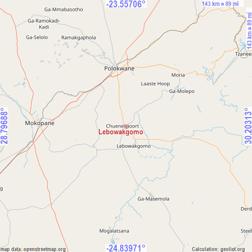
Lebowakgomo GPS coordinates[2]
24° 12' 0" South, 29° 30' 0" East
| Map corner | latitude | longitude |
|---|---|---|
| Upper-left | -23.55706°, | 28.79688° |
| Center: | -24.2°, | 29.5° |
| Lower-right: | -24.83971°, | 30.20313° |
| Map W x H: | 142.6×142.6 km | = 88.6×88.6mi |
| max Lat: | -22.34881° ⇑4.7% North |
| Lebowakgomo: | -24.2° |
| min Lat: | ⇓95.3% South -34.66739° |
| min Long | Lebowakgomo | max Long |
| 16.8697° | 29.5° | 32.26762° |
| W 74.9%⇐ | ⇒25.1% E |
Elevation
Elevation of Lebowakgomo is 1161 m = 3809 ft, and this is 191.4 m = 628 ft above average elevation for this country.
| Max E: |
1873 m = 6145 ft | 46.6% |
| Lebowakgomo | 1161 m 3809 ft | |
| Avg. | 969.6 m = 3181 ft | |
Min E: |
7 m = 23 ft | 53.4% |
See also: South Africa elevation on elevation.city.
Geographical zone
Lebowakgomo is located in South temperate zone (between Tropic of Capricorn and the Antarctic Circle). Distance of this Southern Tropic circle is 84.9 km =52.8 mi to North.| Distance of | km | miles | from Lebowakgomo |
|---|---|---|---|
| Equator | 2690.8 | 1672 | to North |
| Tropic Capricorn | 84.9 | 52.8 | to North |
| Antarctic Circle | 4710.4 | 2926.9 | to South |
| South Pole | 7316.3 | 4546.1 | to South |


Nearby cities:
15 places around Lebowakgomo: (largest is in red/bold)
• Apel
34.8 km =21.6 mi,  133°
133°
• Bochum
108 km =67.1 mi,  340°
340°
• Burgersfort
99.2 km =61.6 mi,  122°
122°
• Dendron
94.4 km =58.7 mi,  349°
349°
• Duiwelskloof
86 km =53.4 mi,  49°
49°
• Ga-Kgapane
96.1 km =59.7 mi, 49°
• Groblersdal
108.2 km =67.2 mi,  185°
185°
• Jane Furse
72.7 km =45.2 mi,  148°
148°
• Mankoeng
46.3 km =28.8 mi,  43°
43°
• Marble Hall
87.8 km =54.6 mi, 193°
• Mokopane
49.7 km =30.9 mi,  270°
270°
• Nkowakowa
87.1 km =54.1 mi,  66°
66°
• Polokwane
33 km =20.5 mi, 354°
• Siyabuswa
111.5 km =69.3 mi,  204°
204°
• Tzaneen
78.8 km =49 mi,  58°
58°
Sources, notices
• [Note1] Compared only with cities in South Africa existing in our database
• [Src1] Map data: © OpenStreetMap contributors (CC-BY-SA)
• [Src2] Other city data from geonames.org with taken over terms of usage.
• [Src3] Geographical zone / Annual Mean Temperature by Robert A. Rohde @ Wikipedia
