Tzaneen geodata
Tzaneen (Limpopo) is a seat of a third-order administrative division; located in South Africa in Africa/Johannesburg (GMT+2) time zone. With population of 16,954 people, there are 159 cities with bigger population in this country. Compared to other cities in South Africa, 97.1% of cities are located further ↓South; 83.2% of cities are located further ←West and 69% of cities have higher elevation than Tzaneen. Note1
Administrative division(s):
- Level 1: Limpopo
- Level 2: Mopani District Municipality
- Level 3: Greater Tzaneen


Tzaneen GPS coordinates[2]
23° 49' 59.592" South, 30° 9' 48.636" East
| Map corner | latitude | longitude |
|---|---|---|
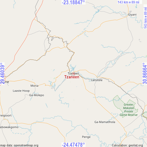
| Upper-left | -23.18847°, | 29.46039° |
| Center: | -23.83322°, | 30.16351° |
| Lower-right: | -24.47478°, | 30.86664° |
| Map W x H: | 143×143 km | = 88.9×88.9mi |
| max Lat: | -22.34881° ⇑2.9% North |
| Tzaneen: | -23.83322° |
| min Lat: | ⇓97.1% South -34.66739° |
| min Long | Tzaneen | max Long |
| 16.8697° | 30.16351° | 32.26762° |
| W 83.2%⇐ | ⇒16.8% E |
Elevation
Elevation of Tzaneen is 719 m = 2359 ft, and this is 250.6 m = 822 ft below average elevation for this country.
| Max E: |
1873 m = 6145 ft | 69% |
| Avg. | 969.6 m = 3181 ft | |
| Tzaneen | 719 m = 2359 ft | |
Min E: |
7 m = 23 ft | 31% |
See also: South Africa elevation on elevation.city.
Geographical zone
Tzaneen is located in South temperate zone (between Tropic of Capricorn and the Antarctic Circle). Distance of this Southern Tropic circle is 44.1 km =27.4 mi to North.| Distance of | km | miles | from Tzaneen |
|---|---|---|---|
| Equator | 2650 | 1646.6 | to North |
| Tropic Capricorn | 44.1 | 27.4 | to North |
| Antarctic Circle | 4751.2 | 2952.3 | to South |
| South Pole | 7357.1 | 4571.5 | to South |


Nearby cities:
15 places around Tzaneen: (largest is in red/bold)
• Apel
77.1 km =47.9 mi,  213°
213°
• Burgersfort
95.1 km =59.1 mi,  169°
169°
• Dendron
100.1 km =62.2 mi,  301°
301°
• Duiwelskloof
15.7 km =9.8 mi,  351°
351°
• Ga-Kgapane
21.9 km =13.6 mi,  16°
16°
• Giyani
81.8 km =50.8 mi,  43°
43°
• Hoedspruit
98.7 km =61.3 mi,  125°
125°
• Jane Furse
107.3 km =66.7 mi,  196°
196°
• Lebowakgomo
78.8 km =49 mi,  238°
238°
• Louis Trichardt
91.7 km =57 mi,  343°
343°
• Mankoeng
36 km =22.4 mi,  258°
258°
• Nkowakowa
14 km =8.7 mi,  115°
115°
• Phalaborwa
100.1 km =62.2 mi,  97°
97°
• Polokwane
71.1 km =44.2 mi, 263°
• Thohoyandou
104 km =64.6 mi, 18°
Sources, notices
• [Note1] Compared only with cities in South Africa existing in our database
• [Src1] Map data: © OpenStreetMap contributors (CC-BY-SA)
• [Src2] Other city data from geonames.org with taken over terms of usage.
• [Src3] Geographical zone / Annual Mean Temperature by Robert A. Rohde @ Wikipedia
