Nkowakowa geodata
Nkowakowa (Limpopo) is a populated place; located in South Africa in Africa/Johannesburg (GMT+2) time zone. With population of 30,138 people, there are 122 cities with bigger population in this country. Compared to other cities in South Africa, 96.8% of cities are located further ↓South; 85% of cities are located further ←West and 72.3% of cities have higher elevation than Nkowakowa. Note1
Administrative division(s):
- Level 1: Limpopo
- Level 2: Mopani District Municipality
- Level 3: Greater Tzaneen


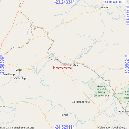
Nkowakowa GPS coordinates[2]
23° 53' 16.152" South, 30° 17' 13.488" East
| Map corner | latitude | longitude |
|---|---|---|
| Upper-left | -23.24334°, | 29.58396° |
| Center: | -23.88782°, | 30.28708° |
| Lower-right: | -24.52911°, | 30.99021° |
| Map W x H: | 143×143 km | = 88.9×88.9mi |
| max Lat: | -22.34881° ⇑3.2% North |
| Nkowakowa: | -23.88782° |
| min Lat: | ⇓96.8% South -34.66739° |
| min Long | Nkowakowa | max Long |
| 16.8697° | 30.28708° | 32.26762° |
| W 85%⇐ | ⇒15% E |
Elevation
Elevation of Nkowakowa is 584 m = 1916 ft, and this is 385.6 m = 1265 ft below average elevation for this country.
| Max E: |
1873 m = 6145 ft | 72.3% |
| Avg. | 969.6 m = 3181 ft | |
| Nkowakowa | 584 m = 1916 ft | |
Min E: |
7 m = 23 ft | 27.7% |
See also: South Africa elevation on elevation.city.
Geographical zone
Nkowakowa is located in South temperate zone (between Tropic of Capricorn and the Antarctic Circle). Distance of this Southern Tropic circle is 50.2 km =31.2 mi to North.| Distance of | km | miles | from Nkowakowa |
|---|---|---|---|
| Equator | 2656.1 | 1650.4 | to North |
| Tropic Capricorn | 50.2 | 31.2 | to North |
| Antarctic Circle | 4745.1 | 2948.5 | to South |
| South Pole | 7351 | 4567.7 | to South |


Nearby cities:
15 places around Nkowakowa: (largest is in red/bold)
• Apel
80 km =49.7 mi,  222°
222°
• Burgersfort
87.7 km =54.5 mi,  177°
177°
• Dendron
114 km =70.8 mi,  300°
300°
• Duiwelskloof
26.3 km =16.3 mi,  325°
325°
• Ga-Kgapane
27.9 km =17.3 mi,  346°
346°
• Giyani
78.6 km =48.8 mi,  34°
34°
• Hoedspruit
85 km =52.8 mi,  127°
127°
• Jane Furse
105.8 km =65.7 mi,  203°
203°
• Lebowakgomo
87.1 km =54.1 mi,  246°
246°
• Louis Trichardt
101.7 km =63.2 mi,  337°
337°
• Mankoeng
47.8 km =29.7 mi,  268°
268°
• Phalaborwa
87 km =54.1 mi,  94°
94°
• Polokwane
83.2 km =51.7 mi, 268°
• Thohoyandou
106.7 km =66.3 mi,  10°
10°
• Tzaneen
14 km =8.7 mi, 295°
Sources, notices
• [Note1] Compared only with cities in South Africa existing in our database
• [Src1] Map data: © OpenStreetMap contributors (CC-BY-SA)
• [Src2] Other city data from geonames.org with taken over terms of usage.
• [Src3] Geographical zone / Annual Mean Temperature by Robert A. Rohde @ Wikipedia
