Ga-Kgapane geodata
Ga-Kgapane (Limpopo) is a populated place; located in South Africa in Africa/Johannesburg (GMT+2) time zone. With population of 13,000 people, there are 181 cities with bigger population in this country. Compared to other cities in South Africa, 97.9% of cities are located further ↓South; 83.8% of cities are located further ←West and 66.7% of cities have higher elevation than Ga-Kgapane. Note1
Administrative division(s):
- Level 1: Limpopo
- Level 2: Mopani District Municipality
- Level 3: Greater Letaba


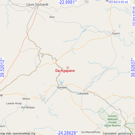
Ga-Kgapane GPS coordinates[2]
23° 38' 37.608" South, 30° 13' 23.664" East
| Map corner | latitude | longitude |
|---|---|---|
| Upper-left | -22.9981°, | 29.52012° |
| Center: | -23.64378°, | 30.22324° |
| Lower-right: | -24.28629°, | 30.92637° |
| Map W x H: | 143.2×143.2 km | = 89×89mi |
| max Lat: | -22.34881° ⇑2.1% North |
| Ga-Kgapane: | -23.64378° |
| min Lat: | ⇓97.9% South -34.66739° |
| min Long | Ga-Kgapane | max Long |
| 16.8697° | 30.22324° | 32.26762° |
| W 83.8%⇐ | ⇒16.2% E |
Elevation
Elevation of Ga-Kgapane is 774 m = 2539 ft, and this is 195.6 m = 642 ft below average elevation for this country.
| Max E: |
1873 m = 6145 ft | 66.7% |
| Avg. | 969.6 m = 3181 ft | |
| Ga-Kgapane | 774 m = 2539 ft | |
Min E: |
7 m = 23 ft | 33.3% |
See also: South Africa elevation on elevation.city.
Geographical zone
Ga-Kgapane is located in South temperate zone (between Tropic of Capricorn and the Antarctic Circle). Distance of this Southern Tropic circle is 23 km =14.3 mi to North.| Distance of | km | miles | from Ga-Kgapane |
|---|---|---|---|
| Equator | 2628.9 | 1633.5 | to North |
| Tropic Capricorn | 23 | 14.3 | to North |
| Antarctic Circle | 4772.2 | 2965.3 | to South |
| South Pole | 7378.1 | 4584.5 | to South |


Nearby cities:
15 places around Ga-Kgapane: (largest is in red/bold)
• Apel
98.3 km =61.1 mi,  209°
209°
• Bochum
117.5 km =73 mi,  289°
289°
• Burgersfort
115.2 km =71.6 mi,  174°
174°
• Dendron
96.8 km =60.1 mi, 288°
• Duiwelskloof
10.1 km =6.3 mi,  236°
236°
• Giyani
63.2 km =39.3 mi,  53°
53°
• Hoedspruit
108.1 km =67.2 mi,  136°
136°
• Lebowakgomo
96.1 km =59.7 mi,  229°
229°
• Louis Trichardt
74.3 km =46.2 mi,  333°
333°
• Mankoeng
50.2 km =31.2 mi, 235°
• Nkowakowa
27.9 km =17.3 mi, 166°
• Phalaborwa
99.1 km =61.6 mi,  109°
109°
• Polokwane
82.1 km =51 mi,  249°
249°
• Thohoyandou
82.1 km =51 mi,  19°
19°
• Tzaneen
21.9 km =13.6 mi,  196°
196°
Sources, notices
• [Note1] Compared only with cities in South Africa existing in our database
• [Src1] Map data: © OpenStreetMap contributors (CC-BY-SA)
• [Src2] Other city data from geonames.org with taken over terms of usage.
• [Src3] Geographical zone / Annual Mean Temperature by Robert A. Rohde @ Wikipedia
