Ladybrand geodata
Ladybrand (Orange Free State) is a seat of a third-order administrative division; located in South Africa in Africa/Johannesburg (GMT+2) time zone. With population of 17,228 people, there are 156 cities with bigger population in this country. Compared to other cities in South Africa, 57.5% of cities are located further ↑North; 52.5% of cities are located further →East and 87.9% of cities have lower elevation than Ladybrand. Note1
Administrative division(s):
- Level 1: Orange Free State
- Level 2: Thabo Mofutsanyana District Municipality
- Level 3: Mantsopa


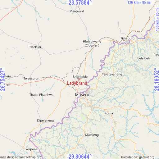
Ladybrand GPS coordinates[2]
29° 11' 40.128" South, 27° 27' 26.604" East
| Map corner | latitude | longitude |
|---|---|---|
| Upper-left | -28.57884°, | 26.75427° |
| Center: | -29.19448°, | 27.45739° |
| Lower-right: | -29.80644°, | 28.16052° |
| Map W x H: | 136.5×136.5 km | = 84.8×84.8mi |
| max Lat: | -22.34881° ⇑57.5% North |
| Ladybrand: | -29.19448° |
| min Lat: | ⇓42.5% South -34.66739° |
| min Long | Ladybrand | max Long |
| 16.8697° | 27.45739° | 32.26762° |
| W 47.5%⇐ | ⇒52.5% E |
Elevation
Elevation of Ladybrand is 1588 m = 5210 ft, and this is 618.4 m = 2029 ft above average elevation for this country.
| Max E: |
1873 m = 6145 ft | 12.1% |
| Ladybrand | 1588 m 5210 ft | |
| Avg. | 969.6 m = 3181 ft | |
Min E: |
7 m = 23 ft | 87.9% |
See also: South Africa elevation on elevation.city.
Geographical zone
Ladybrand is located in South temperate zone (between Tropic of Capricorn and the Antarctic Circle). Distance of this Southern Tropic circle is 640.2 km =397.8 mi to North.| Distance of | km | miles | from Ladybrand |
|---|---|---|---|
| Equator | 3246.1 | 2017 | to North |
| Tropic Capricorn | 640.2 | 397.8 | to North |
| Antarctic Circle | 4155.1 | 2581.9 | to South |
| South Pole | 6760.9 | 4201 | to South |


Nearby cities:
15 places around Ladybrand: (largest is in red/bold)
• Bethlehem
135.5 km =84.2 mi,  37°
37°
• Bloemfontein
121 km =75.2 mi,  273°
273°
• Botshabelo
71.4 km =44.4 mi,  263°
263°
• Brandfort
111.6 km =69.3 mi,  299°
299°
• Clocolan
32.9 km =20.4 mi,  18°
18°
• Dewetsdorp
88.1 km =54.7 mi,  240°
240°
• Ficksburg
54.2 km =33.7 mi,  48°
48°
• Marquard
59 km =36.7 mi,  357°
357°
• Senekal
98.6 km =61.3 mi,  9°
9°
• Thaba Nchu
60 km =37.3 mi, 268°
• Theunissen
114.1 km =70.9 mi,  319°
319°
• Ventersburg
127.2 km =79 mi,  345°
345°
• Virginia
134.3 km =83.5 mi,  334°
334°
• Winburg
87 km =54.1 mi, 329°
• Zastron
128.3 km =79.7 mi,  196°
196°
Sources, notices
• [Note1] Compared only with cities in South Africa existing in our database
• [Src1] Map data: © OpenStreetMap contributors (CC-BY-SA)
• [Src2] Other city data from geonames.org with taken over terms of usage.
• [Src3] Geographical zone / Annual Mean Temperature by Robert A. Rohde @ Wikipedia
