Witbank geodata
Witbank (Mpumalanga) is a seat of a third-order administrative division; located in South Africa in Africa/Johannesburg (GMT+2) time zone. With population of 262,491 people, there are 20 cities with bigger population in this country. Compared to other cities in South Africa, 84.7% of cities are located further ↓South; 71.4% of cities are located further ←West and 92% of cities have lower elevation than Witbank. Note1
Administrative division(s):
- Level 1: Mpumalanga
- Level 2: Nkangala District Municipality
- Level 3: Emalahleni


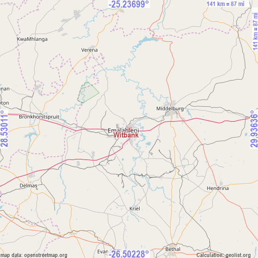
Witbank GPS coordinates[2]
25° 52' 16.788" South, 29° 13' 59.628" East
| Map corner | latitude | longitude |
|---|---|---|
| Upper-left | -25.23699°, | 28.53011° |
| Center: | -25.87133°, | 29.23323° |
| Lower-right: | -26.50228°, | 29.93636° |
| Map W x H: | 140.7×140.7 km | = 87.4×87.4mi |
| max Lat: | -22.34881° ⇑15.3% North |
| Witbank: | -25.87133° |
| min Lat: | ⇓84.7% South -34.66739° |
| min Long | Witbank | max Long |
| 16.8697° | 29.23323° | 32.26762° |
| W 71.4%⇐ | ⇒28.6% E |
Elevation
Elevation of Witbank is 1629 m = 5344 ft, and this is 659.4 m = 2163 ft above average elevation for this country.
| Max E: |
1873 m = 6145 ft | 8% |
| Witbank | 1629 m 5344 ft | |
| Avg. | 969.6 m = 3181 ft | |
Min E: |
7 m = 23 ft | 92% |
See also: Witbank elevation on elevation.city.
Geographical zone
Witbank is located in South temperate zone (between Tropic of Capricorn and the Antarctic Circle). Distance of this Southern Tropic circle is 270.7 km =168.2 mi to North.| Distance of | km | miles | from Witbank |
|---|---|---|---|
| Equator | 2876.6 | 1787.4 | to North |
| Tropic Capricorn | 270.7 | 168.2 | to North |
| Antarctic Circle | 4524.6 | 2811.5 | to South |
| South Pole | 7130.4 | 4430.6 | to South |


Nearby cities:
15 places around Witbank: (largest is in red/bold)
• Belfast
82.8 km =51.4 mi,  75°
75°
• Bethal
69.2 km =43 mi,  160°
160°
• Breyten
89.2 km =55.4 mi,  122°
122°
• Bronkhorstspruit
49.6 km =30.8 mi,  277°
277°
• Carolina
90.8 km =56.4 mi,  104°
104°
• Cullinan
74.5 km =46.3 mi,  287°
287°
• Delmas
62.9 km =39.1 mi,  240°
240°
• Ekangala
52.2 km =32.4 mi, 291°
• Groblersdal
79.8 km =49.6 mi,  11°
11°
• Hendrina
57.8 km =35.9 mi, 123°
• Kriel
44.8 km =27.8 mi,  181°
181°
• Middelburg
25.5 km =15.8 mi,  65°
65°
• Secunda
75.8 km =47.1 mi,  185°
185°
• Siyabuswa
86.4 km =53.7 mi,  347°
347°
• eMbalenhle
75.5 km =46.9 mi, 192°
Sources, notices
• [Note1] Compared only with cities in South Africa existing in our database
• [Src1] Map data: © OpenStreetMap contributors (CC-BY-SA)
• [Src2] Other city data from geonames.org with taken over terms of usage.
• [Src3] Geographical zone / Annual Mean Temperature by Robert A. Rohde @ Wikipedia
