Mabopane geodata
Mabopane (Gauteng) is a populated place; located in South Africa in Africa/Johannesburg (GMT+2) time zone. With population of 97,417 people, there are 54 cities with bigger population in this country. Compared to other cities in South Africa, 89.4% of cities are located further ↓South; 57.2% of cities are located further ←West and 58.1% of cities have lower elevation than Mabopane. Note1
Administrative division(s):
- Level 1: Gauteng
- Level 2: City of Tshwane Metropolitan Municipality
- Level 3: City of Tshwane


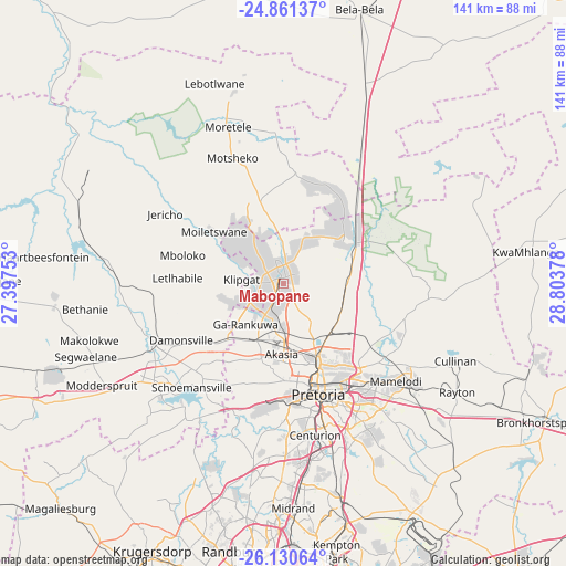
Mabopane GPS coordinates[2]
25° 29' 51.648" South, 28° 6' 2.34" East
| Map corner | latitude | longitude |
|---|---|---|
| Upper-left | -24.86137°, | 27.39753° |
| Center: | -25.49768°, | 28.10065° |
| Lower-right: | -26.13064°, | 28.80378° |
| Map W x H: | 141.1×141.1 km | = 87.7×87.7mi |
| max Lat: | -22.34881° ⇑10.6% North |
| Mabopane: | -25.49768° |
| min Lat: | ⇓89.4% South -34.66739° |
| min Long | Mabopane | max Long |
| 16.8697° | 28.10065° | 32.26762° |
| W 57.2%⇐ | ⇒42.8% E |
Elevation
Elevation of Mabopane is 1225 m = 4019 ft, and this is 255.4 m = 838 ft above average elevation for this country.
| Max E: |
1873 m = 6145 ft | 41.9% |
| Mabopane | 1225 m 4019 ft | |
| Avg. | 969.6 m = 3181 ft | |
Min E: |
7 m = 23 ft | 58.1% |
See also: Mabopane elevation on elevation.city.
Geographical zone
Mabopane is located in South temperate zone (between Tropic of Capricorn and the Antarctic Circle). Distance of this Southern Tropic circle is 229.2 km =142.4 mi to North.| Distance of | km | miles | from Mabopane |
|---|---|---|---|
| Equator | 2835.1 | 1761.6 | to North |
| Tropic Capricorn | 229.2 | 142.4 | to North |
| Antarctic Circle | 4566.1 | 2837.2 | to South |
| South Pole | 7172 | 4456.5 | to South |


Nearby cities:
15 places around Mabopane: (largest is in red/bold)
• Brits
35.6 km =22.1 mi,  244°
244°
• Centurion
41.1 km =25.5 mi,  168°
168°
• Cullinan
46.6 km =29 mi,  114°
114°
• Diepsloot
49.2 km =30.6 mi,  190°
190°
• Eden Glen Ext 60
70.2 km =43.6 mi, 174°
• Ekangala
68.7 km =42.7 mi, 108°
• Ga-Rankuwa
17 km =10.6 mi,  218°
218°
• Makapanstad
28.4 km =17.6 mi,  5°
5°
• Midrand
54.8 km =34.1 mi,  177°
177°
• Midstream
47.8 km =29.7 mi, 168°
• Modderfontein
66.1 km =41.1 mi, 174°
• Muldersdriseloop
65.5 km =40.7 mi,  203°
203°
• Pretoria
28.8 km =17.9 mi,  162°
162°
• Randburg
67.1 km =41.7 mi, 188°
• Tembisa
56.9 km =35.4 mi, 167°
Sources, notices
• [Note1] Compared only with cities in South Africa existing in our database
• [Src1] Map data: © OpenStreetMap contributors (CC-BY-SA)
• [Src2] Other city data from geonames.org with taken over terms of usage.
• [Src3] Geographical zone / Annual Mean Temperature by Robert A. Rohde @ Wikipedia
