Shwāk geodata
Shwāk (Paktia) is a seat of a second-order administrative division; located in Afghanistan in Asia/Kabul (GMT+4.5) time zone. In our database, there are 93 cities with bigger population. Compared to other cities in Afghanistan, 75.9% of cities are located further ↑North; 70.7% of cities are located further ←West and 87.1% of cities have lower elevation than Shwāk. Note1


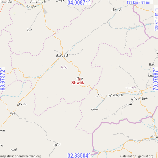
Shwāk GPS coordinates[2]
33° 25' 25.896" North, 69° 22' 36.624" East
| Map corner | latitude | longitude |
|---|---|---|
| Upper-left | 34.00871°, | 68.67372° |
| Center: | 33.42386°, | 69.37684° |
| Lower-right: | 32.83504°, | 70.07997° |
| Map W x H: | 130.5×130.5 km | = 81.1×81.1mi |
| max Lat: | 38.4435° ⇑75.9% North |
| Shwāk: | 33.42386° |
| min Lat: | ⇓24.1% South 30.15° |
| min Long | Shwāk | max Long |
| 61.06667° | 69.37684° | 72.318° |
| W 70.7%⇐ | ⇒29.3% E |
Elevation
Elevation of Shwāk is 2300 m = 7546 ft, and this is 881.6 m = 2892 ft above average elevation for this country.
| Max E: |
3068 m = 10066 ft | 12.9% |
| Shwāk | 2300 m 7546 ft | |
| Avg. | 1418.4 m = 4654 ft | |
Min E: |
254 m = 833 ft | 87.1% |
See also: Afghanistan elevation on elevation.city.
Geographical zone
Shwāk is located in North temperate zone (between Tropic of Cancer and the Arctic Circle). Distance of this Northern Tropic circle is 1110.5 km =690 mi to South.| Distance of | km | miles | from Shwāk |
|---|---|---|---|
| North Pole | 6290.7 | 3908.9 | to North |
| Arctic Circle | 3684.8 | 2289.6 | to North |
| Tropic Cancer | 1110.5 | 690 | to South |
| Equator | 3716.4 | 2309.3 | to South |


Nearby cities:
15 places around Shwāk: (largest is in red/bold)
• Dwah Manḏay
25 km =15.5 mi,  129°
129°
• Gardez
23.8 km =14.8 mi,  324°
324°
• Khōst
51.3 km =31.9 mi,  100°
100°
• Maīdān Khūlah
45.1 km =28 mi,  56°
56°
• Mutā Khān
51.6 km =32.1 mi,  246°
246°
• Nīkêh
27.8 km =17.3 mi,  200°
200°
• Salām Khēl
27.8 km =17.3 mi,  350°
350°
• Shaykh Amīr Kêlay
52 km =32.3 mi,  106°
106°
• Spērah
27.8 km =17.3 mi,  152°
152°
• Stêr Giyān
49.7 km =30.9 mi,  180°
180°
• Urgun
55.5 km =34.5 mi, 198°
• Wulêswālī Sayyid Karam
29.7 km =18.5 mi,  358°
358°
• Zerok-Alakadari
30.1 km =18.7 mi,  191°
191°
• Zorkot
35.7 km =22.2 mi,  68°
68°
• Zurmat
32.4 km =20.1 mi,  272°
272°
Sources, notices
• [Note1] Compared only with cities in Afghanistan existing in our database
• [Src1] Map data: © OpenStreetMap contributors (CC-BY-SA)
• [Src2] Other city data from geonames.org with taken over terms of usage.
• [Src3] Geographical zone / Annual Mean Temperature by Robert A. Rohde @ Wikipedia
