Barg-e Matāl geodata
Barg-e Matāl (Nuristan) is a seat of a second-order administrative division; located in Afghanistan in Asia/Kabul (GMT+4.5) time zone. In our database, there are 93 cities with bigger population. Compared to other cities in Afghanistan, 71.4% of cities are located further ↓South; 98.1% of cities are located further ←West and 76.5% of cities have lower elevation than Barg-e Matāl. Note1


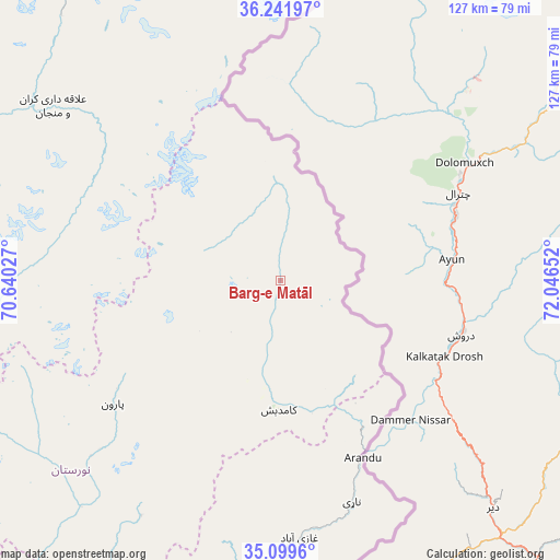
Barg-e Matāl GPS coordinates[2]
35° 40' 22.188" North, 71° 20' 36.204" East
| Map corner | latitude | longitude |
|---|---|---|
| Upper-left | 36.24197°, | 70.64027° |
| Center: | 35.67283°, | 71.34339° |
| Lower-right: | 35.0996°, | 72.04652° |
| Map W x H: | 127×127 km | = 78.9×78.9mi |
| max Lat: | 38.4435° ⇑28.6% North |
| Barg-e Matāl: | 35.67283° |
| min Lat: | ⇓71.4% South 30.15° |
| min Long | Barg-e Matāl | max Long |
| 61.06667° | 71.34339° | 72.318° |
| W 98.1%⇐ | ⇒1.9% E |
Elevation
Elevation of Barg-e Matāl is 2077 m = 6814 ft, and this is 658.6 m = 2161 ft above average elevation for this country.
| Max E: |
3068 m = 10066 ft | 23.5% |
| Barg-e Matāl | 2077 m 6814 ft | |
| Avg. | 1418.4 m = 4654 ft | |
Min E: |
254 m = 833 ft | 76.5% |
See also: Afghanistan elevation on elevation.city.
Geographical zone
Barg-e Matāl is located in North temperate zone (between Tropic of Cancer and the Arctic Circle). Distance of this Northern Tropic circle is 1360.5 km =845.4 mi to South.| Distance of | km | miles | from Barg-e Matāl |
|---|---|---|---|
| North Pole | 6040.6 | 3753.5 | to North |
| Arctic Circle | 3434.7 | 2134.2 | to North |
| Tropic Cancer | 1360.5 | 845.4 | to South |
| Equator | 3966.4 | 2464.6 | to South |


Nearby cities:
15 places around Barg-e Matāl: (largest is in red/bold)
• Asadābād
90.7 km =56.4 mi,  191°
191°
• Ashkāsham
113.6 km =70.6 mi,  8°
8°
• Dāngām
76 km =47.2 mi,  174°
174°
• Ghurayd Gharamē
106.7 km =66.3 mi,  332°
332°
• Kanḏay
95 km =59 mi,  212°
212°
• Karbori
78.8 km =49 mi,  184°
184°
• Kuran wa Munjan
64.9 km =40.3 mi,  307°
307°
• Manogay
85.4 km =53.1 mi, 207°
• Narang
105 km =65.2 mi, 194°
• Nāṟay
52.9 km =32.9 mi,  162°
162°
• Pārūn
47.3 km =29.4 mi,  233°
233°
• Sar Kāṉī
100.4 km =62.4 mi, 192°
• Wuṯahpūr
86.7 km =53.9 mi, 194°
• Zaybāk
95.2 km =59.2 mi,  0°
0°
• Āsmār
71.1 km =44.2 mi, 178°
Sources, notices
• [Note1] Compared only with cities in Afghanistan existing in our database
• [Src1] Map data: © OpenStreetMap contributors (CC-BY-SA)
• [Src2] Other city data from geonames.org with taken over terms of usage.
• [Src3] Geographical zone / Annual Mean Temperature by Robert A. Rohde @ Wikipedia
