Kōṯowāl geodata
Kōṯowāl (Nangarhar) is a seat of a second-order administrative division; located in Afghanistan in Asia/Kabul (GMT+4.5) time zone. In our database, there are 93 cities with bigger population. Compared to other cities in Afghanistan, 65.3% of cities are located further ↑North; 88.4% of cities are located further ←West and 52.7% of cities have lower elevation than Kōṯowāl. Note1


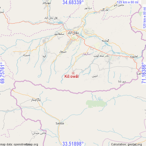
Kōṯowāl GPS coordinates[2]
34° 6' 11.484" North, 70° 27' 38.628" East
| Map corner | latitude | longitude |
|---|---|---|
| Upper-left | 34.68339°, | 69.75761° |
| Center: | 34.10319°, | 70.46073° |
| Lower-right: | 33.51898°, | 71.16386° |
| Map W x H: | 129.5×129.5 km | = 80.5×80.5mi |
| max Lat: | 38.4435° ⇑65.3% North |
| Kōṯowāl: | 34.10319° |
| min Lat: | ⇓34.7% South 30.15° |
| min Long | Kōṯowāl | max Long |
| 61.06667° | 70.46073° | 72.318° |
| W 88.4%⇐ | ⇒11.6% E |
Elevation
Elevation of Kōṯowāl is 1464 m = 4803 ft, and this is 45.6 m = 150 ft above average elevation for this country.
| Max E: |
3068 m = 10066 ft | 47.3% |
| Kōṯowāl | 1464 m 4803 ft | |
| Avg. | 1418.4 m = 4654 ft | |
Min E: |
254 m = 833 ft | 52.7% |
See also: Afghanistan elevation on elevation.city.
Geographical zone
Kōṯowāl is located in North temperate zone (between Tropic of Cancer and the Arctic Circle). Distance of this Northern Tropic circle is 1186 km =736.9 mi to South.| Distance of | km | miles | from Kōṯowāl |
|---|---|---|---|
| North Pole | 6215.1 | 3861.9 | to North |
| Arctic Circle | 3609.3 | 2242.7 | to North |
| Tropic Cancer | 1186 | 736.9 | to South |
| Equator | 3791.9 | 2356.2 | to South |


Nearby cities:
15 places around Kōṯowāl: (largest is in red/bold)
• Bāsawul
41.1 km =25.5 mi,  67°
67°
• Gōshtah
39.7 km =24.7 mi,  44°
44°
• Jalālābād
36 km =22.4 mi,  358°
358°
• Kai
23.9 km =14.9 mi,  83°
83°
• Kaz̲h̲ah
29.8 km =18.5 mi,  300°
300°
• Khafizan
22 km =13.7 mi,  338°
338°
• Markaz-e Woluswalī-ye Āchīn
22.9 km =14.2 mi, 83°
• Māmā Khēl
45.5 km =28.3 mi,  290°
290°
• Pachīr wa Āgām
20 km =12.4 mi, 302°
• Qal‘ah-ye Shāhī
61.9 km =38.5 mi,  11°
11°
• Qarghah’ī
54 km =33.6 mi, 338°
• Sangar Sarāy
37.6 km =23.4 mi,  25°
25°
• Sheywah
53.4 km =33.2 mi, 12°
• Sulţānpūr-e ‘Ulyā
37.5 km =23.3 mi, 336°
• Tsapêraī
58.4 km =36.3 mi,  238°
238°
Sources, notices
• [Note1] Compared only with cities in Afghanistan existing in our database
• [Src1] Map data: © OpenStreetMap contributors (CC-BY-SA)
• [Src2] Other city data from geonames.org with taken over terms of usage.
• [Src3] Geographical zone / Annual Mean Temperature by Robert A. Rohde @ Wikipedia
