Tsapêraī geodata
Tsapêraī (Paktia) is a seat of a second-order administrative division; located in Afghanistan in Asia/Kabul (GMT+4.5) time zone. In our database, there are 93 cities with bigger population. Compared to other cities in Afghanistan, 68.8% of cities are located further ↑North; 81% of cities are located further ←West and 61.7% of cities have lower elevation than Tsapêraī. Note1


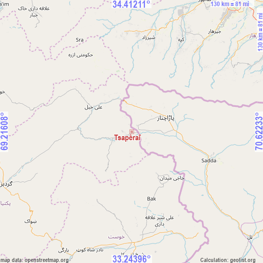
Tsapêraī GPS coordinates[2]
33° 49' 48.108" North, 69° 55' 9.12" East
| Map corner | latitude | longitude |
|---|---|---|
| Upper-left | 34.41211°, | 69.21608° |
| Center: | 33.83003°, | 69.9192° |
| Lower-right: | 33.24396°, | 70.62233° |
| Map W x H: | 129.9×129.9 km | = 80.7×80.7mi |
| max Lat: | 38.4435° ⇑68.8% North |
| Tsapêraī: | 33.83003° |
| min Lat: | ⇓31.2% South 30.15° |
| min Long | Tsapêraī | max Long |
| 61.06667° | 69.9192° | 72.318° |
| W 81%⇐ | ⇒19% E |
Elevation
Elevation of Tsapêraī is 1679 m = 5509 ft, and this is 260.6 m = 855 ft above average elevation for this country.
| Max E: |
3068 m = 10066 ft | 38.3% |
| Tsapêraī | 1679 m 5509 ft | |
| Avg. | 1418.4 m = 4654 ft | |
Min E: |
254 m = 833 ft | 61.7% |
See also: Afghanistan elevation on elevation.city.
Geographical zone
Tsapêraī is located in North temperate zone (between Tropic of Cancer and the Arctic Circle). Distance of this Northern Tropic circle is 1155.6 km =718.1 mi to South.| Distance of | km | miles | from Tsapêraī |
|---|---|---|---|
| North Pole | 6245.5 | 3880.8 | to North |
| Arctic Circle | 3639.6 | 2261.5 | to North |
| Tropic Cancer | 1155.6 | 718.1 | to South |
| Equator | 3761.5 | 2337.3 | to South |


Nearby cities:
15 places around Tsapêraī: (largest is in red/bold)
• Kaz̲h̲ah
51.7 km =32.1 mi,  27°
27°
• Khulbisāt
38.1 km =23.7 mi,  167°
167°
• Khōst
54.5 km =33.9 mi,  179°
179°
• Kōṯowāl
58.4 km =36.3 mi,  58°
58°
• Maīdān Khūlah
23.8 km =14.8 mi,  212°
212°
• Māmā Khēl
46.7 km =29 mi,  8°
8°
• Pachīr wa Āgām
52.8 km =32.8 mi,  38°
38°
• Salām Khēl
57.3 km =35.6 mi,  251°
251°
• Shaykh Amīr Kêlay
60.3 km =37.5 mi, 180°
• Tsamkanī
9.9 km =6.2 mi, 252°
• Wulêswālī Sayyid Karam
53.2 km =33.1 mi, 253°
• Zorkot
36.4 km =22.6 mi, 208°
• Ḩukūmatī Azrah
45.8 km =28.5 mi,  326°
326°
• ‘Alī Khēl
22.3 km =13.9 mi,  304°
304°
• ‘Alī Shēr ‘Alāqahdārī
45.9 km =28.5 mi,  162°
162°
Sources, notices
• [Note1] Compared only with cities in Afghanistan existing in our database
• [Src1] Map data: © OpenStreetMap contributors (CC-BY-SA)
• [Src2] Other city data from geonames.org with taken over terms of usage.
• [Src3] Geographical zone / Annual Mean Temperature by Robert A. Rohde @ Wikipedia
