Khinj geodata
Khinj (Panjshir) is a seat of a second-order administrative division; located in Afghanistan in Asia/Kabul (GMT+4.5) time zone. In our database, there are 93 cities with bigger population. Compared to other cities in Afghanistan, 68.2% of cities are located further ↓South; 78.5% of cities are located further ←West and 84.6% of cities have lower elevation than Khinj. Note1


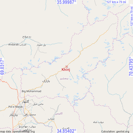
Khinj GPS coordinates[2]
35° 25' 44.328" North, 69° 44' 5.352" East
| Map corner | latitude | longitude |
|---|---|---|
| Upper-left | 35.99987°, | 69.0317° |
| Center: | 35.42898°, | 69.73482° |
| Lower-right: | 34.85402°, | 70.43795° |
| Map W x H: | 127.4×127.4 km | = 79.2×79.2mi |
| max Lat: | 38.4435° ⇑31.8% North |
| Khinj: | 35.42898° |
| min Lat: | ⇓68.2% South 30.15° |
| min Long | Khinj | max Long |
| 61.06667° | 69.73482° | 72.318° |
| W 78.5%⇐ | ⇒21.5% E |
Elevation
Elevation of Khinj is 2225 m = 7300 ft, and this is 806.6 m = 2646 ft above average elevation for this country.
| Max E: |
3068 m = 10066 ft | 15.4% |
| Khinj | 2225 m 7300 ft | |
| Avg. | 1418.4 m = 4654 ft | |
Min E: |
254 m = 833 ft | 84.6% |
See also: Afghanistan elevation on elevation.city.
Geographical zone
Khinj is located in North temperate zone (between Tropic of Cancer and the Arctic Circle). Distance of this Northern Tropic circle is 1333.4 km =828.5 mi to South.| Distance of | km | miles | from Khinj |
|---|---|---|---|
| North Pole | 6067.7 | 3770.3 | to North |
| Arctic Circle | 3461.8 | 2151.1 | to North |
| Tropic Cancer | 1333.4 | 828.5 | to South |
| Equator | 3939.3 | 2447.8 | to South |


Nearby cities:
15 places around Khinj: (largest is in red/bold)
• Alah Sāy
59.2 km =36.8 mi,  181°
181°
• Banū
48.6 km =30.2 mi,  297°
297°
• Bāgh-e Maīdān
52.6 km =32.7 mi,  243°
243°
• Bāzārak
23.7 km =14.7 mi, 237°
• Deh-e Şalāḩ
47.8 km =29.7 mi,  307°
307°
• Ibrāhīm Khān
60.2 km =37.4 mi,  226°
226°
• Jabal os Saraj
56.8 km =35.3 mi, 232°
• Kirāmān
15.4 km =9.6 mi,  198°
198°
• Mandōl
42.6 km =26.5 mi,  112°
112°
• Now Dahānak
32.7 km =20.3 mi,  48°
48°
• Pul-e Ḩişār
31.8 km =19.8 mi, 311°
• Shērwānī-ye Bālā
47.7 km =29.6 mi,  194°
194°
• Sidqābād
57 km =35.4 mi,  217°
217°
• Ḩājī Khēl
44.9 km =27.9 mi, 217°
• ’Unābah
39.1 km =24.3 mi, 236°
Sources, notices
• [Note1] Compared only with cities in Afghanistan existing in our database
• [Src1] Map data: © OpenStreetMap contributors (CC-BY-SA)
• [Src2] Other city data from geonames.org with taken over terms of usage.
• [Src3] Geographical zone / Annual Mean Temperature by Robert A. Rohde @ Wikipedia
