Now Dahānak geodata
Now Dahānak (Panjshir) is a seat of a second-order administrative division; located in Afghanistan in Asia/Kabul (GMT+4.5) time zone. In our database, there are 93 cities with bigger population. Compared to other cities in Afghanistan, 70.7% of cities are located further ↓South; 82.3% of cities are located further ←West and 97.1% of cities have lower elevation than Now Dahānak. Note1


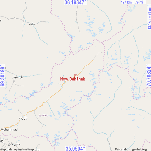
Now Dahānak GPS coordinates[2]
35° 37' 26.328" North, 70° 0' 18.396" East
| Map corner | latitude | longitude |
|---|---|---|
| Upper-left | 36.19347°, | 69.30199° |
| Center: | 35.62398°, | 70.00511° |
| Lower-right: | 35.0504°, | 70.70824° |
| Map W x H: | 127.1×127.1 km | = 79×79mi |
| max Lat: | 38.4435° ⇑29.3% North |
| Now Dahānak: | 35.62398° |
| min Lat: | ⇓70.7% South 30.15° |
| min Long | Now Dahānak | max Long |
| 61.06667° | 70.00511° | 72.318° |
| W 82.3%⇐ | ⇒17.7% E |
Elevation
Elevation of Now Dahānak is 2629 m = 8625 ft, and this is 1210.6 m = 3972 ft above average elevation for this country.
| Max E: |
3068 m = 10066 ft | 2.9% |
| Now Dahānak | 2629 m 8625 ft | |
| Avg. | 1418.4 m = 4654 ft | |
Min E: |
254 m = 833 ft | 97.1% |
See also: Afghanistan elevation on elevation.city.
Geographical zone
Now Dahānak is located in North temperate zone (between Tropic of Cancer and the Arctic Circle). Distance of this Northern Tropic circle is 1355.1 km =842 mi to South.| Distance of | km | miles | from Now Dahānak |
|---|---|---|---|
| North Pole | 6046 | 3756.8 | to North |
| Arctic Circle | 3440.2 | 2137.6 | to North |
| Tropic Cancer | 1355.1 | 842 | to South |
| Equator | 3961 | 2461.3 | to South |


Nearby cities:
15 places around Now Dahānak: (largest is in red/bold)
• Alah Sāy
84.9 km =52.8 mi,  197°
197°
• Banū
67.3 km =41.8 mi,  270°
270°
• Bāgh-e Maīdān
84.5 km =52.5 mi,  238°
238°
• Bāzārak
56.3 km =35 mi,  232°
232°
• Deh-e Şalāḩ
62.8 km =39 mi,  276°
276°
• Dowlat Shāh
75.1 km =46.7 mi,  175°
175°
• Khinj
32.7 km =20.3 mi, 228°
• Kirāmān
46.7 km =29 mi,  218°
218°
• Kuran wa Munjan
82.5 km =51.3 mi,  56°
56°
• Mandōl
40.6 km =25.2 mi,  158°
158°
• Pul-e Ḩişār
48.2 km =30 mi, 269°
• Pārūn
86.1 km =53.5 mi,  105°
105°
• Shērwānī-ye Bālā
77.1 km =47.9 mi,  208°
208°
• Ḩājī Khēl
77.2 km =48 mi, 222°
• ’Unābah
71.6 km =44.5 mi, 232°
Sources, notices
• [Note1] Compared only with cities in Afghanistan existing in our database
• [Src1] Map data: © OpenStreetMap contributors (CC-BY-SA)
• [Src2] Other city data from geonames.org with taken over terms of usage.
• [Src3] Geographical zone / Annual Mean Temperature by Robert A. Rohde @ Wikipedia
