Ashkāsham geodata
Ashkāsham (Badakhshan) is a populated place; located in Afghanistan in Asia/Kabul (GMT+4.5) time zone. With population of 12,120 people, there are 59 cities with bigger population in this country. Compared to other cities in Afghanistan, 84.2% of cities are located further ↓South; 99.7% of cities are located further ←West and 99.7% of cities have lower elevation than Ashkāsham. Note1


Ashkāsham GPS coordinates[2]
36° 40' 59.988" North, 71° 31' 59.988" East
| Map corner | latitude | longitude |
|---|---|---|
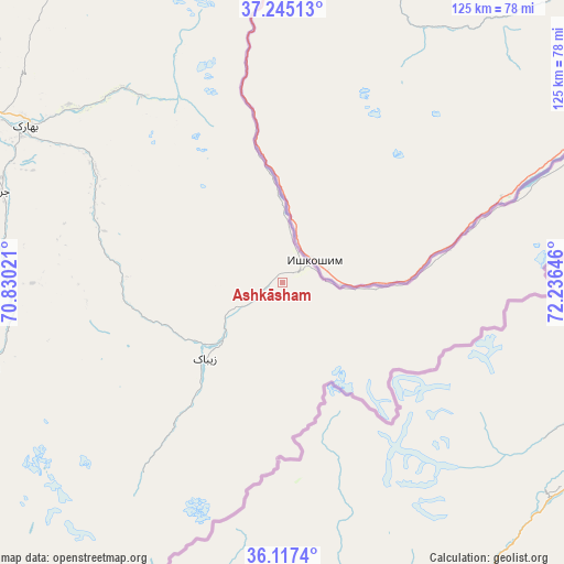
| Upper-left | 37.24513°, | 70.83021° |
| Center: | 36.68333°, | 71.53333° |
| Lower-right: | 36.1174°, | 72.23646° |
| Map W x H: | 125.4×125.4 km | = 77.9×77.9mi |
| max Lat: | 38.4435° ⇑15.8% North |
| Ashkāsham: | 36.68333° |
| min Lat: | ⇓84.2% South 30.15° |
| min Long | Ashkāsham | max Long |
| 61.06667° | 71.53333° | 72.318° |
| W 99.7%⇐ | ⇒0.3% E |
Elevation
Elevation of Ashkāsham is 3057 m = 10030 ft, and this is 1638.6 m = 5376 ft above average elevation for this country.
| Max E: |
3068 m = 10066 ft | 0.3% |
| Ashkāsham | 3057 m 10030 ft | |
| Avg. | 1418.4 m = 4654 ft | |
Min E: |
254 m = 833 ft | 99.7% |
See also: Afghanistan elevation on elevation.city.
Geographical zone
Ashkāsham is located in North temperate zone (between Tropic of Cancer and the Arctic Circle). Distance of this Northern Tropic circle is 1472.9 km =915.2 mi to South.| Distance of | km | miles | from Ashkāsham |
|---|---|---|---|
| North Pole | 5928.3 | 3683.7 | to North |
| Arctic Circle | 3322.4 | 2064.4 | to North |
| Tropic Cancer | 1472.9 | 915.2 | to South |
| Equator | 4078.8 | 2534.4 | to South |


Nearby cities:
15 places around Ashkāsham: (largest is in red/bold)
• Bahārak
66.1 km =41.1 mi,  302°
302°
• Barg-e Matāl
113.6 km =70.6 mi,  188°
188°
• Bāzār-e Tashkān
114.1 km =70.9 mi,  281°
281°
• Chākarān
48.5 km =30.1 mi, 301°
• Darāyim
104.4 km =64.9 mi, 281°
• Fayzabad
97.5 km =60.6 mi, 299°
• Ghurayd Gharamē
68.7 km =42.7 mi,  254°
254°
• Jurm
65.5 km =40.7 mi,  287°
287°
• Khandūd
75.9 km =47.2 mi,  66°
66°
• Kuran wa Munjan
99.7 km =62 mi,  223°
223°
• Mashhad
128.4 km =79.8 mi, 276°
• Pas Pul
119.7 km =74.4 mi,  317°
317°
• Shahrān
78 km =48.5 mi, 295°
• Zaybāk
24 km =14.9 mi, 224°
• Ḩāfiz̧ Moghul
109 km =67.7 mi, 292°
Sources, notices
• [Note1] Compared only with cities in Afghanistan existing in our database
• [Src1] Map data: © OpenStreetMap contributors (CC-BY-SA)
• [Src2] Other city data from geonames.org with taken over terms of usage.
• [Src3] Geographical zone / Annual Mean Temperature by Robert A. Rohde @ Wikipedia
