Zaybāk geodata
Zaybāk (Badakhshan) is a seat of a second-order administrative division; located in Afghanistan in Asia/Kabul (GMT+4.5) time zone. In our database, there are 93 cities with bigger population. Compared to other cities in Afghanistan, 81.4% of cities are located further ↓South; 98.4% of cities are located further ←West and 96.5% of cities have lower elevation than Zaybāk. Note1


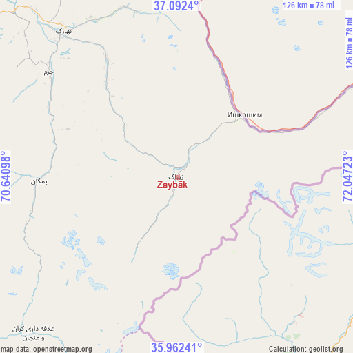
Zaybāk GPS coordinates[2]
36° 31' 46.092" North, 71° 20' 38.76" East
| Map corner | latitude | longitude |
|---|---|---|
| Upper-left | 37.0924°, | 70.64098° |
| Center: | 36.52947°, | 71.3441° |
| Lower-right: | 35.96241°, | 72.04723° |
| Map W x H: | 125.6×125.6 km | = 78×78mi |
| max Lat: | 38.4435° ⇑18.6% North |
| Zaybāk: | 36.52947° |
| min Lat: | ⇓81.4% South 30.15° |
| min Long | Zaybāk | max Long |
| 61.06667° | 71.3441° | 72.318° |
| W 98.4%⇐ | ⇒1.6% E |
Elevation
Elevation of Zaybāk is 2616 m = 8583 ft, and this is 1197.6 m = 3929 ft above average elevation for this country.
| Max E: |
3068 m = 10066 ft | 3.5% |
| Zaybāk | 2616 m 8583 ft | |
| Avg. | 1418.4 m = 4654 ft | |
Min E: |
254 m = 833 ft | 96.5% |
See also: Afghanistan elevation on elevation.city.
Geographical zone
Zaybāk is located in North temperate zone (between Tropic of Cancer and the Arctic Circle). Distance of this Northern Tropic circle is 1455.8 km =904.6 mi to South.| Distance of | km | miles | from Zaybāk |
|---|---|---|---|
| North Pole | 5945.4 | 3694.3 | to North |
| Arctic Circle | 3339.5 | 2075.1 | to North |
| Tropic Cancer | 1455.8 | 904.6 | to South |
| Equator | 4061.7 | 2523.8 | to South |


Nearby cities:
15 places around Zaybāk: (largest is in red/bold)
• Ashkāsham
24 km =14.9 mi,  44°
44°
• Bahārak
65.5 km =40.7 mi,  323°
323°
• Barg-e Matāl
95.2 km =59.2 mi,  180°
180°
• Bāzār-e Tashkān
102.9 km =63.9 mi,  292°
292°
• Chākarān
49 km =30.4 mi,  329°
329°
• Darāyim
93.5 km =58.1 mi, 293°
• Fayzabad
94.3 km =58.6 mi,  313°
313°
• Ghurayd Gharamē
49.5 km =30.8 mi,  269°
269°
• Jurm
58.8 km =36.5 mi, 309°
• Khandūd
98.6 km =61.3 mi,  61°
61°
• Kuran wa Munjan
75.7 km =47 mi,  222°
222°
• Mashhad
115.3 km =71.6 mi, 286°
• Pas Pul
123.3 km =76.6 mi, 328°
• Shahrān
73.6 km =45.7 mi, 312°
• Ḩāfiz̧ Moghul
102.4 km =63.6 mi,  304°
304°
Sources, notices
• [Note1] Compared only with cities in Afghanistan existing in our database
• [Src1] Map data: © OpenStreetMap contributors (CC-BY-SA)
• [Src2] Other city data from geonames.org with taken over terms of usage.
• [Src3] Geographical zone / Annual Mean Temperature by Robert A. Rohde @ Wikipedia
