Ghurayd Gharamē geodata
Ghurayd Gharamē (Badakhshan) is a seat of a second-order administrative division; located in Afghanistan in Asia/Kabul (GMT+4.5) time zone. In our database, there are 93 cities with bigger population. Compared to other cities in Afghanistan, 81% of cities are located further ↓South; 93.2% of cities are located further ←West and 69.1% of cities have lower elevation than Ghurayd Gharamē. Note1


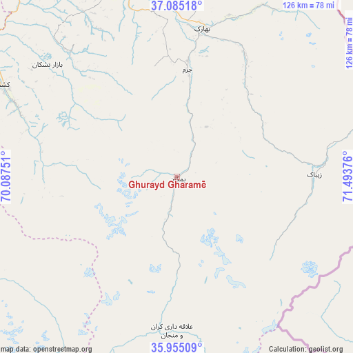
Ghurayd Gharamē GPS coordinates[2]
36° 31' 19.92" North, 70° 47' 26.268" East
| Map corner | latitude | longitude |
|---|---|---|
| Upper-left | 37.08518°, | 70.08751° |
| Center: | 36.5222°, | 70.79063° |
| Lower-right: | 35.95509°, | 71.49376° |
| Map W x H: | 125.7×125.7 km | = 78.1×78.1mi |
| max Lat: | 38.4435° ⇑19% North |
| Ghurayd Gharamē: | 36.5222° |
| min Lat: | ⇓81% South 30.15° |
| min Long | Ghurayd Gharam� | max Long |
| 61.06667° | 70.79063° | 72.318° |
| W 93.2%⇐ | ⇒6.8% E |
Elevation
Elevation of Ghurayd Gharamē is 1884 m = 6181 ft, and this is 465.6 m = 1528 ft above average elevation for this country.
| Max E: |
3068 m = 10066 ft | 30.9% |
| Ghurayd Gharamē | 1884 m 6181 ft | |
| Avg. | 1418.4 m = 4654 ft | |
Min E: |
254 m = 833 ft | 69.1% |
See also: Afghanistan elevation on elevation.city.
Geographical zone
Ghurayd Gharamē is located in North temperate zone (between Tropic of Cancer and the Arctic Circle). Distance of this Northern Tropic circle is 1455 km =904.1 mi to South.| Distance of | km | miles | from Ghurayd Gharamē |
|---|---|---|---|
| North Pole | 5946.2 | 3694.8 | to North |
| Arctic Circle | 3340.3 | 2075.6 | to North |
| Tropic Cancer | 1455 | 904.1 | to South |
| Equator | 4060.9 | 2523.3 | to South |


Nearby cities:
15 places around Ghurayd Gharamē: (largest is in red/bold)
• Ashkāsham
68.7 km =42.7 mi,  74°
74°
• Bahārak
54.4 km =33.8 mi,  10°
10°
• Bāzār-e Tashkān
60.8 km =37.8 mi,  311°
311°
• Chākarān
49.8 km =30.9 mi,  29°
29°
• Darāyim
52.8 km =32.8 mi,  316°
316°
• Farkhār
83.5 km =51.9 mi,  273°
273°
• Fayzabad
68.7 km =42.7 mi,  344°
344°
• Jurm
38.3 km =23.8 mi, 5°
• Kalafgān
80.4 km =50 mi,  290°
290°
• Kuran wa Munjan
54.9 km =34.1 mi,  181°
181°
• Mashhad
69.6 km =43.2 mi,  298°
298°
• Shahrān
51.1 km =31.8 mi,  354°
354°
• Zaybāk
49.5 km =30.8 mi,  89°
89°
• Ţāqchah Khānah
104.4 km =64.9 mi,  275°
275°
• Ḩāfiz̧ Moghul
68.8 km =42.8 mi,  329°
329°
Sources, notices
• [Note1] Compared only with cities in Afghanistan existing in our database
• [Src1] Map data: © OpenStreetMap contributors (CC-BY-SA)
• [Src2] Other city data from geonames.org with taken over terms of usage.
• [Src3] Geographical zone / Annual Mean Temperature by Robert A. Rohde @ Wikipedia
