Dowlat Shāh geodata
Dowlat Shāh (Laghman) is a seat of a second-order administrative division; located in Afghanistan in Asia/Kabul (GMT+4.5) time zone. In our database, there are 93 cities with bigger population. Compared to other cities in Afghanistan, 58.2% of cities are located further ↓South; 83.3% of cities are located further ←West and 56.3% of cities have lower elevation than Dowlat Shāh. Note1


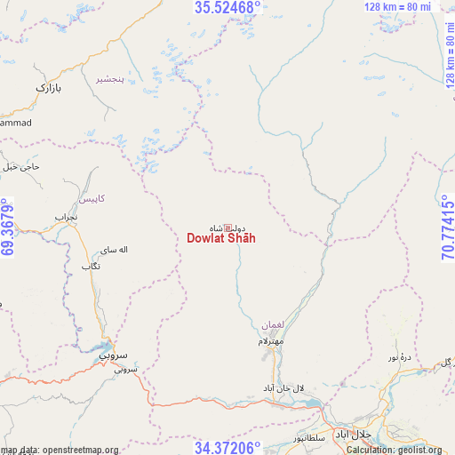
Dowlat Shāh GPS coordinates[2]
34° 57' 1.44" North, 70° 4' 15.672" East
| Map corner | latitude | longitude |
|---|---|---|
| Upper-left | 35.52468°, | 69.3679° |
| Center: | 34.9504°, | 70.07102° |
| Lower-right: | 34.37206°, | 70.77415° |
| Map W x H: | 128.2×128.2 km | = 79.7×79.7mi |
| max Lat: | 38.4435° ⇑41.8% North |
| Dowlat Shāh: | 34.9504° |
| min Lat: | ⇓58.2% South 30.15° |
| min Long | Dowlat Shāh | max Long |
| 61.06667° | 70.07102° | 72.318° |
| W 83.3%⇐ | ⇒16.7% E |
Elevation
Elevation of Dowlat Shāh is 1551 m = 5089 ft, and this is 132.6 m = 435 ft above average elevation for this country.
| Max E: |
3068 m = 10066 ft | 43.7% |
| Dowlat Shāh | 1551 m 5089 ft | |
| Avg. | 1418.4 m = 4654 ft | |
Min E: |
254 m = 833 ft | 56.3% |
See also: Afghanistan elevation on elevation.city.
Geographical zone
Dowlat Shāh is located in North temperate zone (between Tropic of Cancer and the Arctic Circle). Distance of this Northern Tropic circle is 1280.2 km =795.5 mi to South.| Distance of | km | miles | from Dowlat Shāh |
|---|---|---|---|
| North Pole | 6120.9 | 3803.3 | to North |
| Arctic Circle | 3515.1 | 2184.2 | to North |
| Tropic Cancer | 1280.2 | 795.5 | to South |
| Equator | 3886.1 | 2414.7 | to South |


Nearby cities:
15 places around Dowlat Shāh: (largest is in red/bold)
• Alah Sāy
32.5 km =20.2 mi,  259°
259°
• Khinj
61.4 km =38.2 mi,  330°
330°
• Kirāmān
52.4 km =32.6 mi,  317°
317°
• Mandōl
38.2 km =23.7 mi,  13°
13°
• Mehtar Lām
33.5 km =20.8 mi,  157°
157°
• Qal‘ah-ye Shāhī
58.1 km =36.1 mi,  125°
125°
• Qarghah’ī
46.8 km =29.1 mi, 160°
• Sarōbī
49.2 km =30.6 mi,  215°
215°
• Sheywah
63.3 km =39.3 mi, 131°
• Shērwānī-ye Bālā
43.6 km =27.1 mi,  279°
279°
• Sulţānpūr-e ‘Ulyā
63.3 km =39.3 mi, 161°
• Tagāb
39.9 km =24.8 mi,  254°
254°
• Wuluswālī ‘Alīngār
29.2 km =18.1 mi,  115°
115°
• Ḏanḏar
57.2 km =35.5 mi, 251°
• Ḩājī Khēl
60.7 km =37.7 mi,  286°
286°
Sources, notices
• [Note1] Compared only with cities in Afghanistan existing in our database
• [Src1] Map data: © OpenStreetMap contributors (CC-BY-SA)
• [Src2] Other city data from geonames.org with taken over terms of usage.
• [Src3] Geographical zone / Annual Mean Temperature by Robert A. Rohde @ Wikipedia
