Dahan-e Jarf geodata
Dahan-e Jarf (Parwan) is a seat of a second-order administrative division; located in Afghanistan in Asia/Kabul (GMT+4.5) time zone. In our database, there are 93 cities with bigger population. Compared to other cities in Afghanistan, 57.6% of cities are located further ↓South; 50.2% of cities are located further ←West and 87.8% of cities have lower elevation than Dahan-e Jarf. Note1


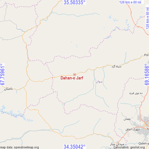
Dahan-e Jarf GPS coordinates[2]
34° 55' 44.076" North, 68° 27' 45.828" East
| Map corner | latitude | longitude |
|---|---|---|
| Upper-left | 35.50335°, | 67.75961° |
| Center: | 34.92891°, | 68.46273° |
| Lower-right: | 34.35042°, | 69.16586° |
| Map W x H: | 128.2×128.2 km | = 79.7×79.7mi |
| max Lat: | 38.4435° ⇑42.4% North |
| Dahan-e Jarf: | 34.92891° |
| min Lat: | ⇓57.6% South 30.15° |
| min Long | Dahan-e Jarf | max Long |
| 61.06667° | 68.46273° | 72.318° |
| W 50.2%⇐ | ⇒49.8% E |
Elevation
Elevation of Dahan-e Jarf is 2306 m = 7566 ft, and this is 887.6 m = 2912 ft above average elevation for this country.
| Max E: |
3068 m = 10066 ft | 12.2% |
| Dahan-e Jarf | 2306 m 7566 ft | |
| Avg. | 1418.4 m = 4654 ft | |
Min E: |
254 m = 833 ft | 87.8% |
See also: Afghanistan elevation on elevation.city.
Geographical zone
Dahan-e Jarf is located in North temperate zone (between Tropic of Cancer and the Arctic Circle). Distance of this Northern Tropic circle is 1277.8 km =794 mi to South.| Distance of | km | miles | from Dahan-e Jarf |
|---|---|---|---|
| North Pole | 6123.3 | 3804.8 | to North |
| Arctic Circle | 3517.4 | 2185.6 | to North |
| Tropic Cancer | 1277.8 | 794 | to South |
| Equator | 3883.7 | 2413.2 | to South |


Nearby cities:
15 places around Dahan-e Jarf: (largest is in red/bold)
• Bulōlah
34.7 km =21.6 mi,  260°
260°
• Bāmyān
59.2 km =36.8 mi, 258°
• Bāzār-e Tālah
55.9 km =34.7 mi,  337°
337°
• Chandal Bā’ī
59.1 km =36.7 mi,  130°
130°
• Deh-e Now
57.1 km =35.5 mi,  110°
110°
• Istālif
57.1 km =35.5 mi,  100°
100°
• Jalrēz
53.9 km =33.5 mi,  161°
161°
• Kalakān
64.8 km =40.3 mi, 104°
• Mīr Bachah Kōṯ
63.1 km =39.2 mi, 108°
• Paghmān
58.5 km =36.4 mi, 130°
• Qarah Bāgh Bāzār
65.1 km =40.5 mi, 97°
• Qāshqāl
51.1 km =31.8 mi,  76°
76°
• Siyāhgird
36.8 km =22.9 mi, 76°
• Surkh Bilandī
58.4 km =36.3 mi,  117°
117°
• Zargarān
56.6 km =35.2 mi, 106°
Sources, notices
• [Note1] Compared only with cities in Afghanistan existing in our database
• [Src1] Map data: © OpenStreetMap contributors (CC-BY-SA)
• [Src2] Other city data from geonames.org with taken over terms of usage.
• [Src3] Geographical zone / Annual Mean Temperature by Robert A. Rohde @ Wikipedia
