Bāmyān geodata
Bāmyān (Bamyan) is a seat of a first-order administrative division; located in Afghanistan in Asia/Kabul (GMT+4.5) time zone. With population of 61,863 people, there are 16 cities with bigger population in this country. Compared to other cities in Afghanistan, 54.3% of cities are located further ↓South; 55.9% of cities are located further →East and 95.2% of cities have lower elevation than Bāmyān. Note1


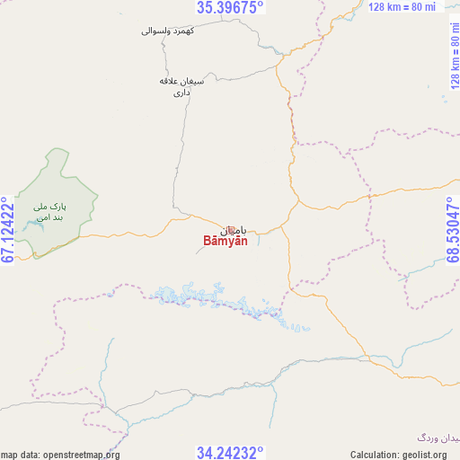
Bāmyān GPS coordinates[2]
34° 49' 17.616" North, 67° 49' 38.424" East
| Map corner | latitude | longitude |
|---|---|---|
| Upper-left | 35.39675°, | 67.12422° |
| Center: | 34.82156°, | 67.82734° |
| Lower-right: | 34.24232°, | 68.53047° |
| Map W x H: | 128.4×128.4 km | = 79.8×79.8mi |
| max Lat: | 38.4435° ⇑45.7% North |
| Bāmyān: | 34.82156° |
| min Lat: | ⇓54.3% South 30.15° |
| min Long | Bāmyān | max Long |
| 61.06667° | 67.82734° | 72.318° |
| W 44.1%⇐ | ⇒55.9% E |
Elevation
Elevation of Bāmyān is 2550 m = 8366 ft, and this is 1131.6 m = 3713 ft above average elevation for this country.
| Max E: |
3068 m = 10066 ft | 4.8% |
| Bāmyān | 2550 m 8366 ft | |
| Avg. | 1418.4 m = 4654 ft | |
Min E: |
254 m = 833 ft | 95.2% |
See also: Bāmyān elevation on elevation.city.
Geographical zone
Bāmyān is located in North temperate zone (between Tropic of Cancer and the Arctic Circle). Distance of this Northern Tropic circle is 1265.9 km =786.6 mi to South.| Distance of | km | miles | from Bāmyān |
|---|---|---|---|
| North Pole | 6135.3 | 3812.3 | to North |
| Arctic Circle | 3529.4 | 2193.1 | to North |
| Tropic Cancer | 1265.9 | 786.6 | to South |
| Equator | 3871.8 | 2405.8 | to South |


Nearby cities:
15 places around Bāmyān: (largest is in red/bold)
• Bulōlah
24.6 km =15.3 mi,  75°
75°
• Bāzār-e Tālah
72.9 km =45.3 mi,  29°
29°
• Dahan-e Jarf
59.2 km =36.8 mi, 78°
• Dūāb
82.4 km =51.2 mi,  359°
359°
• Jalrēz
85.1 km =52.9 mi,  117°
117°
• Khudāydād Khēl
41.7 km =25.9 mi,  342°
342°
• Maydanshakhr
106.2 km =66 mi, 116°
• Mīrān
80.3 km =49.9 mi,  146°
146°
• Nayak
80.4 km =50 mi,  263°
263°
• Paghmān
105.9 km =65.8 mi,  104°
104°
• Panjāb
88 km =54.7 mi,  236°
236°
• Rū-ye Sang
58.1 km =36.1 mi, 342°
• Siyāhgird
96 km =59.7 mi, 77°
• Wulêswālī Bihsūd
53.6 km =33.3 mi,  172°
172°
• Ōkak
103.4 km =64.2 mi, 173°
Sources, notices
• [Note1] Compared only with cities in Afghanistan existing in our database
• [Src1] Map data: © OpenStreetMap contributors (CC-BY-SA)
• [Src2] Other city data from geonames.org with taken over terms of usage.
• [Src3] Geographical zone / Annual Mean Temperature by Robert A. Rohde @ Wikipedia
