Pul-e ‘Alam geodata
Pul-e ‘Alam (Logar) is a seat of a first-order administrative division; located in Afghanistan in Asia/Kabul (GMT+4.5) time zone. With population of 13,247 people, there are 54 cities with bigger population in this country. Compared to other cities in Afghanistan, 66.6% of cities are located further ↑North; 59.2% of cities are located further ←West and 70.1% of cities have lower elevation than Pul-e ‘Alam. Note1


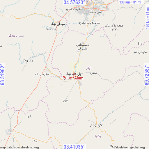
Pul-e ‘Alam GPS coordinates[2]
33° 59' 43.044" North, 69° 1' 21.864" East
| Map corner | latitude | longitude |
|---|---|---|
| Upper-left | 34.57623°, | 68.31962° |
| Center: | 33.99529°, | 69.02274° |
| Lower-right: | 33.41035°, | 69.72587° |
| Map W x H: | 129.6×129.6 km | = 80.5×80.5mi |
| max Lat: | 38.4435° ⇑66.6% North |
| Pul-e ‘Alam: | 33.99529° |
| min Lat: | ⇓33.4% South 30.15° |
| min Long | Pul-e ‘Alam | max Long |
| 61.06667° | 69.02274° | 72.318° |
| W 59.2%⇐ | ⇒40.8% E |
Elevation
Elevation of Pul-e ‘Alam is 1921 m = 6302 ft, and this is 502.6 m = 1649 ft above average elevation for this country.
| Max E: |
3068 m = 10066 ft | 29.9% |
| Pul-e ‘Alam | 1921 m 6302 ft | |
| Avg. | 1418.4 m = 4654 ft | |
Min E: |
254 m = 833 ft | 70.1% |
See also: Afghanistan elevation on elevation.city.
Geographical zone
Pul-e ‘Alam is located in North temperate zone (between Tropic of Cancer and the Arctic Circle). Distance of this Northern Tropic circle is 1174 km =729.5 mi to South.| Distance of | km | miles | from Pul-e ‘Alam |
|---|---|---|---|
| North Pole | 6227.1 | 3869.3 | to North |
| Arctic Circle | 3621.3 | 2250.2 | to North |
| Tropic Cancer | 1174 | 729.5 | to South |
| Equator | 3779.9 | 2348.7 | to South |


Nearby cities:
15 places around Pul-e ‘Alam: (largest is in red/bold)
• Bagrāmī
60.1 km =37.3 mi,  22°
22°
• Baraki Barak
7.5 km =4.7 mi,  245°
245°
• Chakaray
54.2 km =33.7 mi,  44°
44°
• Charkh
23.4 km =14.5 mi,  199°
199°
• Gardez
48.1 km =29.9 mi,  157°
157°
• Kabul
60.8 km =37.8 mi,  13°
13°
• Kalān Deh
59.9 km =37.2 mi, 252°
• Khōshī
17.8 km =11.1 mi,  88°
88°
• Markaz-e Sayyidābād
28.5 km =17.7 mi,  271°
271°
• Maydanshakhr
46.8 km =29.1 mi,  342°
342°
• Muḩammad Āghah Wuluswālī
25.4 km =15.8 mi, 16°
• Qal‘ah-ye Na‘īm
46.9 km =29.1 mi, 16°
• Salām Khēl
45.9 km =28.5 mi,  141°
141°
• Wulêswālī Sayyid Karam
46.6 km =29 mi, 136°
• Ḩukūmatī Azrah
60.7 km =37.7 mi,  70°
70°
Sources, notices
• [Note1] Compared only with cities in Afghanistan existing in our database
• [Src1] Map data: © OpenStreetMap contributors (CC-BY-SA)
• [Src2] Other city data from geonames.org with taken over terms of usage.
• [Src3] Geographical zone / Annual Mean Temperature by Robert A. Rohde @ Wikipedia
