Ushi geodata
Ushi (Aragatsotn) is a populated place; located in Armenia in Asia/Yerevan (GMT+4) time zone. With population of 1,276 people, there are 253 cities with bigger population in this country. Compared to other cities in Armenia, 62.7% of cities are located further ↓South; 66.2% of cities are located further →East and 55.4% of cities have lower elevation than Ushi. Note1


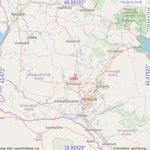
Ushi GPS coordinates[2]
40° 20' 50.244" North, 44° 22' 30.432" East
| Map corner | latitude | longitude |
|---|---|---|
| Upper-left | 40.88103°, | 43.672° |
| Center: | 40.34729°, | 44.37512° |
| Lower-right: | 39.80929°, | 45.07825° |
| Map W x H: | 119.2×119.2 km | = 74.1×74.1mi |
| max Lat: | 41.24358° ⇑37.3% North |
| Ushi: | 40.34729° |
| min Lat: | ⇓62.7% South 38.90292° |
| min Long | Ushi | max Long |
| 43.74722° | 44.37512° | 46.5446° |
| W 33.8%⇐ | ⇒66.2% E |
Elevation
Elevation of Ushi is 1394 m = 4573 ft, and this is 92.5 m = 303 ft above average elevation for this country.
| Max E: |
2169 m = 7116 ft | 44.6% |
| Ushi | 1394 m 4573 ft | |
| Avg. | 1301.5 m = 4270 ft | |
Min E: |
440 m = 1444 ft | 55.4% |
See also: Armenia elevation on elevation.city.
Geographical zone
Ushi is located in North temperate zone (between Tropic of Cancer and the Arctic Circle). Distance of this Northern Tropic circle is 1880.3 km =1168.4 mi to South.| Distance of | km | miles | from Ushi |
|---|---|---|---|
| North Pole | 5520.9 | 3430.5 | to North |
| Arctic Circle | 2915 | 1811.3 | to North |
| Tropic Cancer | 1880.3 | 1168.4 | to South |
| Equator | 4486.2 | 2787.6 | to South |


Nearby cities:
15 places around Ushi: (largest is in red/bold)
• Aragats
15.9 km =9.9 mi,  353°
353°
• Aragyugh
15.6 km =9.7 mi,  66°
66°
• Ashtarak
5.5 km =3.4 mi,  191°
191°
• Aygeshat
14.4 km =8.9 mi,  210°
210°
• Byurakan
8.7 km =5.4 mi,  263°
263°
• Karbi
1.9 km =1.2 mi,  172°
172°
• Mrgashen
15.9 km =9.9 mi,  115°
115°
• Nor Yerznka
5.4 km =3.4 mi, 167°
• Oshakan
10.5 km =6.5 mi, 208°
• Prroshyan
11.7 km =7.3 mi,  161°
161°
• Sasunik
11.1 km =6.9 mi, 193°
• Shenavan
15.1 km =9.4 mi,  2°
2°
• Voskevaz
10.2 km =6.3 mi,  218°
218°
• Yeghvard
9.7 km =6 mi,  104°
104°
• Zoravan
12.5 km =7.8 mi,  85°
85°
Sources, notices
• [Note1] Compared only with cities in Armenia existing in our database
• [Src1] Map data: © OpenStreetMap contributors (CC-BY-SA)
• [Src2] Other city data from geonames.org with taken over terms of usage.
• [Src3] Geographical zone / Annual Mean Temperature by Robert A. Rohde @ Wikipedia
