Noratus geodata
Noratus (Gegharkunik) is a populated place; located in Armenia in Asia/Yerevan (GMT+4) time zone. With population of 5,426 people, there are 37 cities with bigger population in this country. Compared to other cities in Armenia, 63.7% of cities are located further ↓South; 80.9% of cities are located further ←West and 88.2% of cities have lower elevation than Noratus. Note1


Noratus GPS coordinates[2]
40° 22' 40.548" North, 45° 10' 49.728" East
| Map corner | latitude | longitude |
|---|---|---|
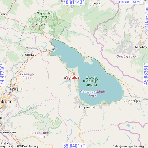
| Upper-left | 40.91143°, | 44.47736° |
| Center: | 40.37793°, | 45.18048° |
| Lower-right: | 39.84017°, | 45.88361° |
| Map W x H: | 119.1×119.1 km | = 74×74mi |
| max Lat: | 41.24358° ⇑36.3% North |
| Noratus: | 40.37793° |
| min Lat: | ⇓63.7% South 38.90292° |
| min Long | Noratus | max Long |
| 43.74722° | 45.18048° | 46.5446° |
| W 80.9%⇐ | ⇒19.1% E |
Elevation
Elevation of Noratus is 1926 m = 6319 ft, and this is 624.5 m = 2049 ft above average elevation for this country.
| Max E: |
2169 m = 7116 ft | 11.8% |
| Noratus | 1926 m 6319 ft | |
| Avg. | 1301.5 m = 4270 ft | |
Min E: |
440 m = 1444 ft | 88.2% |
See also: Armenia elevation on elevation.city.
Geographical zone
Noratus is located in North temperate zone (between Tropic of Cancer and the Arctic Circle). Distance of this Northern Tropic circle is 1883.7 km =1170.5 mi to South.| Distance of | km | miles | from Noratus |
|---|---|---|---|
| North Pole | 5517.5 | 3428.4 | to North |
| Arctic Circle | 2911.6 | 1809.2 | to North |
| Tropic Cancer | 1883.7 | 1170.5 | to South |
| Equator | 4489.6 | 2789.7 | to South |


Nearby cities:
15 places around Noratus: (largest is in red/bold)
• Drakhtik
21.3 km =13.2 mi,  12°
12°
• Dzoragyugh
23.2 km =14.4 mi,  179°
179°
• Gandzak
9.1 km =5.7 mi,  219°
219°
• Gavarr
5.5 km =3.4 mi,  240°
240°
• Lanjaghbyur
12.4 km =7.7 mi,  194°
194°
• Lchap’
12.4 km =7.7 mi,  314°
314°
• Lchashen
26.4 km =16.4 mi, 306°
• Lichk’
24.7 km =15.3 mi,  169°
169°
• Nerk’in Getashen
27.4 km =17 mi,  163°
163°
• Sarukhan
10.5 km =6.5 mi,  203°
203°
• Sevan
27.6 km =17.1 mi, 312°
• Tsovasar
26.7 km =16.6 mi, 178°
• Tsovazard
15.4 km =9.6 mi, 314°
• Vardadzor
21.3 km =13.2 mi, 177°
• Yeranos
19.3 km =12 mi, 177°
Sources, notices
• [Note1] Compared only with cities in Armenia existing in our database
• [Src1] Map data: © OpenStreetMap contributors (CC-BY-SA)
• [Src2] Other city data from geonames.org with taken over terms of usage.
• [Src3] Geographical zone / Annual Mean Temperature by Robert A. Rohde @ Wikipedia
