Urrut geodata
Urrut (Lori) is a populated place; located in Armenia in Asia/Yerevan (GMT+4) time zone. With population of 1,102 people, there are 286 cities with bigger population in this country. Compared to other cities in Armenia, 96.2% of cities are located further ↓South; 62.1% of cities are located further →East and 60.2% of cities have lower elevation than Urrut. Note1


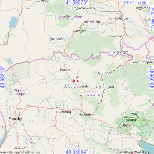
Urrut GPS coordinates[2]
41° 4' 4.008" North, 44° 23' 46.608" East
| Map corner | latitude | longitude |
|---|---|---|
| Upper-left | 41.59575°, | 43.69316° |
| Center: | 41.06778°, | 44.39628° |
| Lower-right: | 40.53554°, | 45.09941° |
| Map W x H: | 117.9×117.9 km | = 73.3×73.3mi |
| max Lat: | 41.24358° ⇑3.8% North |
| Urrut: | 41.06778° |
| min Lat: | ⇓96.2% South 38.90292° |
| min Long | Urrut | max Long |
| 43.74722° | 44.39628° | 46.5446° |
| W 37.9%⇐ | ⇒62.1% E |
Elevation
Elevation of Urrut is 1459 m = 4787 ft, and this is 157.5 m = 517 ft above average elevation for this country.
| Max E: |
2169 m = 7116 ft | 39.8% |
| Urrut | 1459 m 4787 ft | |
| Avg. | 1301.5 m = 4270 ft | |
Min E: |
440 m = 1444 ft | 60.2% |
See also: Armenia elevation on elevation.city.
Geographical zone
Urrut is located in North temperate zone (between Tropic of Cancer and the Arctic Circle). Distance of this Northern Tropic circle is 1960.4 km =1218.1 mi to South.| Distance of | km | miles | from Urrut |
|---|---|---|---|
| North Pole | 5440.8 | 3380.8 | to North |
| Arctic Circle | 2834.9 | 1761.5 | to North |
| Tropic Cancer | 1960.4 | 1218.1 | to South |
| Equator | 4566.3 | 2837.4 | to South |


Nearby cities:
15 places around Urrut: (largest is in red/bold)
• Agarak
8.8 km =5.5 mi,  136°
136°
• Alaverdi
23.4 km =14.5 mi,  81°
81°
• Arevashogh
25.2 km =15.7 mi,  203°
203°
• Bazum
22.6 km =14 mi,  170°
170°
• Darpas
25.8 km =16 mi, 174°
• Dsegh
24.3 km =15.1 mi,  118°
118°
• Gogaran
25.6 km =15.9 mi,  220°
220°
• Gyulagarak
12.8 km =8 mi,  150°
150°
• Metsavan
20.4 km =12.7 mi,  316°
316°
• Norashen
14.5 km =9 mi,  338°
338°
• Odzun
18.3 km =11.4 mi,  95°
95°
• Step’anavan
6.5 km =4 mi,  188°
188°
• Tashir
11.1 km =6.9 mi,  302°
302°
• Vahagni
25.3 km =15.7 mi, 135°
• Vardablur
14.3 km =8.9 mi, 138°
Sources, notices
• [Note1] Compared only with cities in Armenia existing in our database
• [Src1] Map data: © OpenStreetMap contributors (CC-BY-SA)
• [Src2] Other city data from geonames.org with taken over terms of usage.
• [Src3] Geographical zone / Annual Mean Temperature by Robert A. Rohde @ Wikipedia
