Yeghegnut geodata
Yeghegnut (Lori) is a populated place; located in Armenia in Asia/Yerevan (GMT+4) time zone. With population of 1,154 people, there are 275 cities with bigger population in this country. Compared to other cities in Armenia, 91.1% of cities are located further ↓South; 59.9% of cities are located further ←West and 56.7% of cities have higher elevation than Yeghegnut. Note1


Yeghegnut GPS coordinates[2]
40° 54' 10.872" North, 44° 37' 53.58" East
| Map corner | latitude | longitude |
|---|---|---|
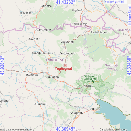
| Upper-left | 41.43232°, | 43.92843° |
| Center: | 40.90302°, | 44.63155° |
| Lower-right: | 40.36945°, | 45.33468° |
| Map W x H: | 118.2×118.2 km | = 73.4×73.4mi |
| max Lat: | 41.24358° ⇑8.9% North |
| Yeghegnut: | 40.90302° |
| min Lat: | ⇓91.1% South 38.90292° |
| min Long | Yeghegnut | max Long |
| 43.74722° | 44.63155° | 46.5446° |
| W 59.9%⇐ | ⇒40.1% E |
Elevation
Elevation of Yeghegnut is 1096 m = 3596 ft, and this is 205.5 m = 674 ft below average elevation for this country.
| Max E: |
2169 m = 7116 ft | 56.7% |
| Avg. | 1301.5 m = 4270 ft | |
| Yeghegnut | 1096 m = 3596 ft | |
Min E: |
440 m = 1444 ft | 43.3% |
See also: Armenia elevation on elevation.city.
Geographical zone
Yeghegnut is located in North temperate zone (between Tropic of Cancer and the Arctic Circle). Distance of this Northern Tropic circle is 1942.1 km =1206.8 mi to South.| Distance of | km | miles | from Yeghegnut |
|---|---|---|---|
| North Pole | 5459.1 | 3392.1 | to North |
| Arctic Circle | 2853.2 | 1772.9 | to North |
| Tropic Cancer | 1942.1 | 1206.8 | to South |
| Equator | 4548 | 2826 | to South |


Nearby cities:
15 places around Yeghegnut: (largest is in red/bold)
• Agarak
18.2 km =11.3 mi,  311°
311°
• Alaverdi
21.9 km =13.6 mi,  9°
9°
• Bazum
16.6 km =10.3 mi,  256°
256°
• Darpas
18.9 km =11.7 mi,  247°
247°
• Dsegh
6.7 km =4.2 mi, 13°
• Fioletovo
21.4 km =13.3 mi,  160°
160°
• Gugark’
13.4 km =8.3 mi,  215°
215°
• Gyulagarak
15.2 km =9.4 mi,  297°
297°
• Lorut
12.3 km =7.6 mi,  72°
72°
• Margahovit
19.3 km =12 mi,  166°
166°
• Odzun
16.8 km =10.4 mi,  354°
354°
• Shahumyan
16 km =9.9 mi,  206°
206°
• Vahagni
2 km =1.2 mi,  282°
282°
• Vanadzor
15.9 km =9.9 mi,  226°
226°
• Vardablur
12.8 km =8 mi, 306°
Sources, notices
• [Note1] Compared only with cities in Armenia existing in our database
• [Src1] Map data: © OpenStreetMap contributors (CC-BY-SA)
• [Src2] Other city data from geonames.org with taken over terms of usage.
• [Src3] Geographical zone / Annual Mean Temperature by Robert A. Rohde @ Wikipedia
