Vahagni geodata
Vahagni (Lori) is a populated place; located in Armenia in Asia/Yerevan (GMT+4) time zone. With population of 1,184 people, there are 271 cities with bigger population in this country. Compared to other cities in Armenia, 91.7% of cities are located further ↓South; 58.9% of cities are located further ←West and 57.3% of cities have higher elevation than Vahagni. Note1


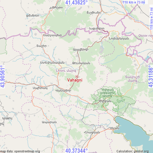
Vahagni GPS coordinates[2]
40° 54' 25.128" North, 44° 36' 31.428" East
| Map corner | latitude | longitude |
|---|---|---|
| Upper-left | 41.43625°, | 43.90561° |
| Center: | 40.90698°, | 44.60873° |
| Lower-right: | 40.37344°, | 45.31186° |
| Map W x H: | 118.2×118.2 km | = 73.4×73.4mi |
| max Lat: | 41.24358° ⇑8.3% North |
| Vahagni: | 40.90698° |
| min Lat: | ⇓91.7% South 38.90292° |
| min Long | Vahagni | max Long |
| 43.74722° | 44.60873° | 46.5446° |
| W 58.9%⇐ | ⇒41.1% E |
Elevation
Elevation of Vahagni is 1076 m = 3530 ft, and this is 225.5 m = 740 ft below average elevation for this country.
| Max E: |
2169 m = 7116 ft | 57.3% |
| Avg. | 1301.5 m = 4270 ft | |
| Vahagni | 1076 m = 3530 ft | |
Min E: |
440 m = 1444 ft | 42.7% |
See also: Armenia elevation on elevation.city.
Geographical zone
Vahagni is located in North temperate zone (between Tropic of Cancer and the Arctic Circle). Distance of this Northern Tropic circle is 1942.5 km =1207 mi to South.| Distance of | km | miles | from Vahagni |
|---|---|---|---|
| North Pole | 5458.6 | 3391.8 | to North |
| Arctic Circle | 2852.7 | 1772.6 | to North |
| Tropic Cancer | 1942.5 | 1207 | to South |
| Equator | 4548.4 | 2826.2 | to South |


Nearby cities:
15 places around Vahagni: (largest is in red/bold)
• Agarak
16.5 km =10.3 mi,  314°
314°
• Alaverdi
21.9 km =13.6 mi,  14°
14°
• Bazum
14.9 km =9.3 mi,  252°
252°
• Darpas
17.3 km =10.7 mi,  243°
243°
• Dsegh
7 km =4.3 mi,  29°
29°
• Gugark’
12.8 km =8 mi,  206°
206°
• Gyulagarak
13.3 km =8.3 mi,  300°
300°
• Lerrnapat
20.8 km =12.9 mi, 240°
• Lorut
14.1 km =8.8 mi,  76°
76°
• Margahovit
20.3 km =12.6 mi,  161°
161°
• Odzun
16.3 km =10.1 mi,  1°
1°
• Shahumyan
15.6 km =9.7 mi,  199°
199°
• Vanadzor
14.9 km =9.3 mi,  220°
220°
• Vardablur
11 km =6.8 mi, 310°
• Yeghegnut
2 km =1.2 mi,  102°
102°
Sources, notices
• [Note1] Compared only with cities in Armenia existing in our database
• [Src1] Map data: © OpenStreetMap contributors (CC-BY-SA)
• [Src2] Other city data from geonames.org with taken over terms of usage.
• [Src3] Geographical zone / Annual Mean Temperature by Robert A. Rohde @ Wikipedia
