Villa Elisa geodata
Villa Elisa (Entre Rios) is a populated place; located in Argentina in America/Argentina/Cordoba (GMT-3) time zone. With population of 9,334 people, there are 304 cities with bigger population in this country. Compared to other cities in Argentina, 52.9% of cities are located further ↑North; 85.3% of cities are located further ←West and 80.6% of cities have higher elevation than Villa Elisa. Note1


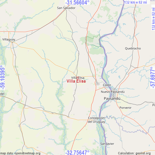
Villa Elisa GPS coordinates[2]
32° 9' 47.52" South, 58° 24' 2.952" West
| Map corner | latitude | longitude |
|---|---|---|
| Upper-left | -31.56604°, | -59.10395° |
| Center: | -32.1632°, | -58.40082° |
| Lower-right: | -32.75647°, | -57.6977° |
| Map W x H: | 132.4×132.4 km | = 82.3×82.3mi |
| max Lat: | -21.94467° ⇑52.9% North |
| Villa Elisa: | -32.1632° |
| min Lat: | ⇓47.1% South -54.81084° |
| min Long | Villa Elisa | max Long |
| -72.88605° | -58.40082° | -53.64581° |
| W 85.3%⇐ | ⇒14.7% E |
Elevation
Elevation of Villa Elisa is 57 m = 187 ft, and this is 292.3 m = 959 ft below average elevation for this country.
| Max E: |
4040 m = 13255 ft | 80.6% |
| Avg. | 349.3 m = 1146 ft | |
| Villa Elisa | 57 m = 187 ft | |
Min E: |
-2 m = -7 ft | 19.4% |
See also: Argentina elevation on elevation.city.
Geographical zone
Villa Elisa is located in South temperate zone (between Tropic of Capricorn and the Antarctic Circle). Distance of this Southern Tropic circle is 970.3 km =602.9 mi to North.| Distance of | km | miles | from Villa Elisa |
|---|---|---|---|
| Equator | 3576.2 | 2222.1 | to North |
| Tropic Capricorn | 970.3 | 602.9 | to North |
| Antarctic Circle | 3825 | 2376.7 | to South |
| South Pole | 6430.8 | 3995.9 | to South |


Nearby cities:
15 places around Villa Elisa: (largest is in red/bold)
• Aldea San Antonio
58.6 km =36.4 mi,  209°
209°
• Caseros
34.2 km =21.3 mi,  192°
192°
• Colonia Elía
57 km =35.4 mi,  172°
172°
• Colón
25 km =15.5 mi,  105°
105°
• Concepción del Uruguay
39.1 km =24.3 mi,  156°
156°
• Domínguez
56.4 km =35 mi,  290°
290°
• Gilbert
64.7 km =40.2 mi,  230°
230°
• Herrera
37.1 km =23.1 mi,  215°
215°
• Pronunciamiento
20.6 km =12.8 mi, 191°
• San Justo
31.7 km =19.7 mi, 185°
• San Salvador
60.7 km =37.7 mi,  350°
350°
• Santa Anita
36.3 km =22.6 mi,  267°
267°
• Ubajay
41.9 km =26 mi,  11°
11°
• Villa Mantero
41.6 km =25.8 mi, 231°
• Villaguay
67.7 km =42.1 mi,  299°
299°
Sources, notices
• [Note1] Compared only with cities in Argentina existing in our database
• [Src1] Map data: © OpenStreetMap contributors (CC-BY-SA)
• [Src2] Other city data from geonames.org with taken over terms of usage.
• [Src3] Geographical zone / Annual Mean Temperature by Robert A. Rohde @ Wikipedia
