Lobería geodata
Lobería (Buenos Aires) is a seat of a second-order administrative division; located in Argentina in America/Argentina/Buenos_Aires (GMT-3) time zone. In our database, there are 785 cities with bigger population. Compared to other cities in Argentina, 89.2% of cities are located further ↑North; 78.6% of cities are located further ←West and 68.6% of cities have higher elevation than Lobería. Note1


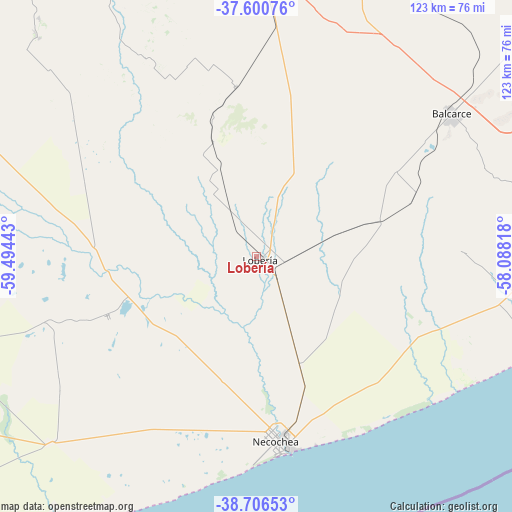
Lobería GPS coordinates[2]
38° 9' 20.664" South, 58° 47' 28.68" West
| Map corner | latitude | longitude |
|---|---|---|
| Upper-left | -37.60076°, | -59.49443° |
| Center: | -38.15574°, | -58.7913° |
| Lower-right: | -38.70653°, | -58.08818° |
| Map W x H: | 123×123 km | = 76.4×76.4mi |
| max Lat: | -21.94467° ⇑89.2% North |
| Lobería: | -38.15574° |
| min Lat: | ⇓10.8% South -54.81084° |
| min Long | Lobería | max Long |
| -72.88605° | -58.7913° | -53.64581° |
| W 78.6%⇐ | ⇒21.4% E |
Elevation
Elevation of Lobería is 82 m = 269 ft, and this is 267.3 m = 877 ft below average elevation for this country.
| Max E: |
4040 m = 13255 ft | 68.6% |
| Avg. | 349.3 m = 1146 ft | |
| Lobería | 82 m = 269 ft | |
Min E: |
-2 m = -7 ft | 31.4% |
See also: Argentina elevation on elevation.city.
Geographical zone
Lobería is located in South temperate zone (between Tropic of Capricorn and the Antarctic Circle). Distance of this Southern Tropic circle is 1636.6 km =1016.9 mi to North.| Distance of | km | miles | from Lobería |
|---|---|---|---|
| Equator | 4242.5 | 2636.2 | to North |
| Tropic Capricorn | 1636.6 | 1016.9 | to North |
| Antarctic Circle | 3158.7 | 1962.7 | to South |
| South Pole | 5764.5 | 3581.9 | to South |


Nearby cities:
15 places around Lobería: (largest is in red/bold)
• Ayacucho
114.8 km =71.3 mi,  13°
13°
• Azul
179.9 km =111.8 mi,  328°
328°
• Balcarce
58.2 km =36.2 mi,  53°
53°
• Benito Juárez
104 km =64.6 mi,  301°
301°
• Coronel Vidal
122.2 km =75.9 mi, 49°
• Maipú
164.7 km =102.3 mi,  29°
29°
• Mar de las Pampas
180.9 km =112.4 mi,  59°
59°
• Mar del Plata
109.5 km =68 mi,  80°
80°
• Miramar
84.2 km =52.3 mi,  98°
98°
• Necochea
44.6 km =27.7 mi,  174°
174°
• Rauch
155.8 km =96.8 mi,  350°
350°
• San Cayetano
74.5 km =46.3 mi,  253°
253°
• Tandil
97.5 km =60.6 mi,  342°
342°
• Tres Arroyos
132.2 km =82.1 mi,  259°
259°
• Villa Gesell
188.2 km =116.9 mi, 58°
Sources, notices
• [Note1] Compared only with cities in Argentina existing in our database
• [Src1] Map data: © OpenStreetMap contributors (CC-BY-SA)
• [Src2] Other city data from geonames.org with taken over terms of usage.
• [Src3] Geographical zone / Annual Mean Temperature by Robert A. Rohde @ Wikipedia
