Chilecito geodata
Chilecito (La Rioja) is a seat of a second-order administrative division; located in Argentina in America/Argentina/La_Rioja (GMT-3) time zone. With population of 42,248 people, there are 103 cities with bigger population in this country. Compared to other cities in Argentina, 67.8% of cities are located further ↓South; 87.7% of cities are located further →East and 93.6% of cities have lower elevation than Chilecito. Note1


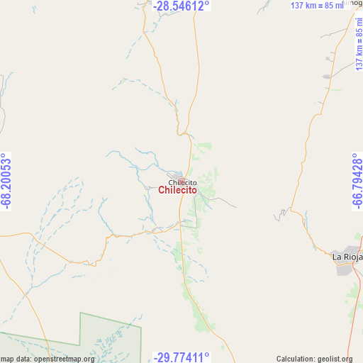
Chilecito GPS coordinates[2]
29° 9' 43.02" South, 67° 29' 50.64" West
| Map corner | latitude | longitude |
|---|---|---|
| Upper-left | -28.54612°, | -68.20053° |
| Center: | -29.16195°, | -67.4974° |
| Lower-right: | -29.77411°, | -66.79428° |
| Map W x H: | 136.5×136.5 km | = 84.8×84.8mi |
| max Lat: | -21.94467° ⇑32.2% North |
| Chilecito: | -29.16195° |
| min Lat: | ⇓67.8% South -54.81084° |
| min Long | Chilecito | max Long |
| -72.88605° | -67.4974° | -53.64581° |
| W 12.3%⇐ | ⇒87.7% E |
Elevation
Elevation of Chilecito is 1125 m = 3691 ft, and this is 775.7 m = 2545 ft above average elevation for this country.
| Max E: |
4040 m = 13255 ft | 6.4% |
| Chilecito | 1125 m 3691 ft | |
| Avg. | 349.3 m = 1146 ft | |
Min E: |
-2 m = -7 ft | 93.6% |
See also: Chilecito elevation on elevation.city.
Geographical zone
Chilecito is located in South temperate zone (between Tropic of Capricorn and the Antarctic Circle). Distance of this Southern Tropic circle is 636.6 km =395.6 mi to North.| Distance of | km | miles | from Chilecito |
|---|---|---|---|
| Equator | 3242.5 | 2014.8 | to North |
| Tropic Capricorn | 636.6 | 395.6 | to North |
| Antarctic Circle | 4158.7 | 2584.1 | to South |
| South Pole | 6764.6 | 4203.3 | to South |


Nearby cities:
15 places around Chilecito: (largest is in red/bold)
• Aimogasta
94.9 km =59 mi,  45°
45°
• Aminga
65.3 km =40.6 mi,  57°
57°
• Arauco
94.3 km =58.6 mi, 46°
• Capayán
147.5 km =91.7 mi,  73°
73°
• Chumbicha
127.4 km =79.2 mi, 74°
• Famatina
26.7 km =16.6 mi,  355°
355°
• La Rioja
68.6 km =42.6 mi,  113°
113°
• Patquía
115 km =71.5 mi,  148°
148°
• San Blas de los Sauces
92.4 km =57.4 mi,  25°
25°
• Sañogasta
37.8 km =23.5 mi,  78°
78°
• Tinogasta
122.3 km =76 mi, 356°
• Villa Bustos
48.3 km =30 mi, 106°
• Villa Castelli
72.4 km =45 mi,  283°
283°
• Villa Unión
72.8 km =45.2 mi,  256°
256°
• Vinchina
82.3 km =51.1 mi,  302°
302°
Sources, notices
• [Note1] Compared only with cities in Argentina existing in our database
• [Src1] Map data: © OpenStreetMap contributors (CC-BY-SA)
• [Src2] Other city data from geonames.org with taken over terms of usage.
• [Src3] Geographical zone / Annual Mean Temperature by Robert A. Rohde @ Wikipedia
