Sañogasta geodata
Sañogasta (La Rioja) is a seat of a second-order administrative division; located in Argentina in America/Argentina/La_Rioja (GMT-3) time zone. In our database, there are 785 cities with bigger population. Compared to other cities in Argentina, 68.5% of cities are located further ↓South; 86.5% of cities are located further →East and 98.2% of cities have lower elevation than Sañogasta. Note1


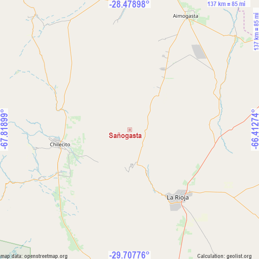
Sañogasta GPS coordinates[2]
29° 5' 42.72" South, 67° 6' 57.096" West
| Map corner | latitude | longitude |
|---|---|---|
| Upper-left | -28.47898°, | -67.81899° |
| Center: | -29.0952°, | -67.11586° |
| Lower-right: | -29.70776°, | -66.41274° |
| Map W x H: | 136.6×136.6 km | = 84.9×84.9mi |
| max Lat: | -21.94467° ⇑31.5% North |
| Sañogasta: | -29.0952° |
| min Lat: | ⇓68.5% South -54.81084° |
| min Long | Sañogasta | max Long |
| -72.88605° | -67.11586° | -53.64581° |
| W 13.5%⇐ | ⇒86.5% E |
Elevation
Elevation of Sañogasta is 2012 m = 6601 ft, and this is 1662.7 m = 5455 ft above average elevation for this country.
| Max E: |
4040 m = 13255 ft | 1.8% |
| Sañogasta | 2012 m 6601 ft | |
| Avg. | 349.3 m = 1146 ft | |
Min E: |
-2 m = -7 ft | 98.2% |
See also: Argentina elevation on elevation.city.
Geographical zone
Sañogasta is located in South temperate zone (between Tropic of Capricorn and the Antarctic Circle). Distance of this Southern Tropic circle is 629.2 km =391 mi to North.| Distance of | km | miles | from Sañogasta |
|---|---|---|---|
| Equator | 3235.1 | 2010.2 | to North |
| Tropic Capricorn | 629.2 | 391 | to North |
| Antarctic Circle | 4166.1 | 2588.7 | to South |
| South Pole | 6772 | 4207.9 | to South |


Nearby cities:
15 places around Sañogasta: (largest is in red/bold)
• Aimogasta
66.6 km =41.4 mi,  26°
26°
• Aminga
32.9 km =20.4 mi, 33°
• Arauco
65.3 km =40.6 mi, 28°
• Capayán
109.9 km =68.3 mi,  71°
71°
• Chilecito
37.8 km =23.5 mi,  258°
258°
• Chumbicha
89.8 km =55.8 mi, 72°
• Famatina
43.7 km =27.2 mi,  296°
296°
• La Rioja
43.5 km =27 mi,  143°
143°
• Patquía
108.2 km =67.2 mi,  167°
167°
• Pomán
117 km =72.7 mi,  48°
48°
• San Blas de los Sauces
76.2 km =47.3 mi,  1°
1°
• Villa Bustos
23.2 km =14.4 mi,  156°
156°
• Villa Castelli
108 km =67.1 mi,  274°
274°
• Villa Unión
110.6 km =68.7 mi, 257°
• Vinchina
112.5 km =69.9 mi,  289°
289°
Sources, notices
• [Note1] Compared only with cities in Argentina existing in our database
• [Src1] Map data: © OpenStreetMap contributors (CC-BY-SA)
• [Src2] Other city data from geonames.org with taken over terms of usage.
• [Src3] Geographical zone / Annual Mean Temperature by Robert A. Rohde @ Wikipedia
