Aminga geodata
Aminga (La Rioja) is a seat of a second-order administrative division; located in Argentina in America/Argentina/La_Rioja (GMT-3) time zone. In our database, there are 785 cities with bigger population. Compared to other cities in Argentina, 69.6% of cities are located further ↓South; 85.6% of cities are located further →East and 96.4% of cities have lower elevation than Aminga. Note1


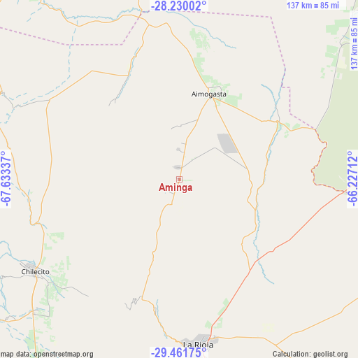
Aminga GPS coordinates[2]
28° 50' 51.756" South, 66° 55' 48.864" West
| Map corner | latitude | longitude |
|---|---|---|
| Upper-left | -28.23002°, | -67.63337° |
| Center: | -28.84771°, | -66.93024° |
| Lower-right: | -29.46175°, | -66.22712° |
| Map W x H: | 137×137 km | = 85.1×85.1mi |
| max Lat: | -21.94467° ⇑30.4% North |
| Aminga: | -28.84771° |
| min Lat: | ⇓69.6% South -54.81084° |
| min Long | Aminga | max Long |
| -72.88605° | -66.93024° | -53.64581° |
| W 14.4%⇐ | ⇒85.6% E |
Elevation
Elevation of Aminga is 1388 m = 4554 ft, and this is 1038.7 m = 3408 ft above average elevation for this country.
| Max E: |
4040 m = 13255 ft | 3.6% |
| Aminga | 1388 m 4554 ft | |
| Avg. | 349.3 m = 1146 ft | |
Min E: |
-2 m = -7 ft | 96.4% |
See also: Argentina elevation on elevation.city.
Geographical zone
Aminga is located in South temperate zone (between Tropic of Capricorn and the Antarctic Circle). Distance of this Southern Tropic circle is 601.6 km =373.8 mi to North.| Distance of | km | miles | from Aminga |
|---|---|---|---|
| Equator | 3207.6 | 1993.1 | to North |
| Tropic Capricorn | 601.6 | 373.8 | to North |
| Antarctic Circle | 4193.6 | 2605.8 | to South |
| South Pole | 6799.5 | 4225 | to South |


Nearby cities:
15 places around Aminga: (largest is in red/bold)
• Aimogasta
34.1 km =21.2 mi,  20°
20°
• Arauco
32.6 km =20.3 mi, 24°
• Capayán
86.4 km =53.7 mi,  84°
84°
• Chilecito
65.3 km =40.6 mi,  237°
237°
• Chumbicha
67.7 km =42.1 mi,  90°
90°
• Famatina
58 km =36 mi,  261°
261°
• Huillapima
93.7 km =58.2 mi, 81°
• La Rioja
63.1 km =39.2 mi,  172°
172°
• Mutquín
96.7 km =60.1 mi,  52°
52°
• Pomán
85.7 km =53.3 mi, 53°
• San Blas de los Sauces
51.2 km =31.8 mi,  341°
341°
• Saujil
102.6 km =63.8 mi,  43°
43°
• Sañogasta
32.9 km =20.4 mi,  213°
213°
• Tinogasta
107 km =66.5 mi,  324°
324°
• Villa Bustos
49.6 km =30.8 mi,  190°
190°
Sources, notices
• [Note1] Compared only with cities in Argentina existing in our database
• [Src1] Map data: © OpenStreetMap contributors (CC-BY-SA)
• [Src2] Other city data from geonames.org with taken over terms of usage.
• [Src3] Geographical zone / Annual Mean Temperature by Robert A. Rohde @ Wikipedia
