Patquía geodata
Patquía (La Rioja) is a seat of a second-order administrative division; located in Argentina in America/Argentina/La_Rioja (GMT-3) time zone. In our database, there are 785 cities with bigger population. Compared to other cities in Argentina, 64.8% of cities are located further ↓South; 85.4% of cities are located further →East and 74.6% of cities have lower elevation than Patquía. Note1


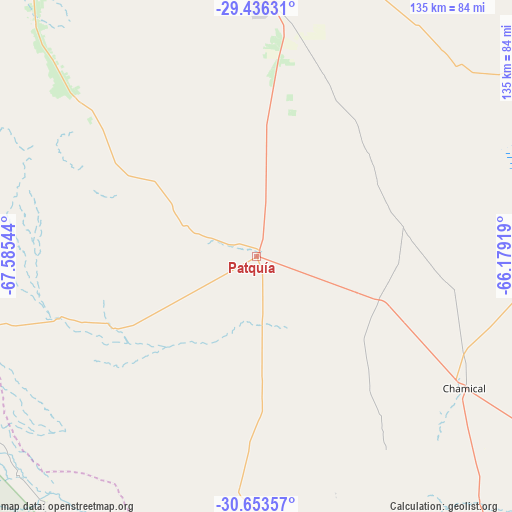
Patquía GPS coordinates[2]
30° 2' 48.516" South, 66° 52' 56.316" West
| Map corner | latitude | longitude |
|---|---|---|
| Upper-left | -29.43631°, | -67.58544° |
| Center: | -30.04681°, | -66.88231° |
| Lower-right: | -30.65357°, | -66.17919° |
| Map W x H: | 135.3×135.3 km | = 84.1×84.1mi |
| max Lat: | -21.94467° ⇑35.2% North |
| Patquía: | -30.04681° |
| min Lat: | ⇓64.8% South -54.81084° |
| min Long | Patquía | max Long |
| -72.88605° | -66.88231° | -53.64581° |
| W 14.6%⇐ | ⇒85.4% E |
Elevation
Elevation of Patquía is 435 m = 1427 ft, and this is 85.7 m = 281 ft above average elevation for this country.
| Max E: |
4040 m = 13255 ft | 25.4% |
| Patquía | 435 m 1427 ft | |
| Avg. | 349.3 m = 1146 ft | |
Min E: |
-2 m = -7 ft | 74.6% |
See also: Argentina elevation on elevation.city.
Geographical zone
Patquía is located in South temperate zone (between Tropic of Capricorn and the Antarctic Circle). Distance of this Southern Tropic circle is 735 km =456.7 mi to North.| Distance of | km | miles | from Patquía |
|---|---|---|---|
| Equator | 3340.9 | 2075.9 | to North |
| Tropic Capricorn | 735 | 456.7 | to North |
| Antarctic Circle | 4060.3 | 2523 | to South |
| South Pole | 6666.2 | 4142.2 | to South |


Nearby cities:
15 places around Patquía: (largest is in red/bold)
• Aminga
133.4 km =82.9 mi,  358°
358°
• Castro Barros
125.7 km =78.1 mi,  118°
118°
• Chamical
64.8 km =40.3 mi, 122°
• Chepes
146.9 km =91.3 mi,  168°
168°
• Chilecito
115 km =71.5 mi,  328°
328°
• Chumbicha
146.7 km =91.2 mi,  25°
25°
• Famatina
139.4 km =86.6 mi, 333°
• La Rioja
70.8 km =44 mi,  2°
2°
• Malanzán
88.2 km =54.8 mi,  162°
162°
• Milagro
136.8 km =85 mi,  141°
141°
• Olta
88.1 km =54.7 mi, 137°
• San Agustín de Valle Fértil
86.1 km =53.5 mi,  220°
220°
• Sañogasta
108.2 km =67.2 mi,  347°
347°
• Tama
61.4 km =38.2 mi,  146°
146°
• Villa Bustos
85.6 km =53.2 mi, 351°
Sources, notices
• [Note1] Compared only with cities in Argentina existing in our database
• [Src1] Map data: © OpenStreetMap contributors (CC-BY-SA)
• [Src2] Other city data from geonames.org with taken over terms of usage.
• [Src3] Geographical zone / Annual Mean Temperature by Robert A. Rohde @ Wikipedia
