Villa Bustos geodata
Villa Bustos (La Rioja) is a populated place; located in Argentina in America/Argentina/La_Rioja (GMT-3) time zone. With population of 2,165 people, there are 625 cities with bigger population in this country. Compared to other cities in Argentina, 67.3% of cities are located further ↓South; 86.1% of cities are located further →East and 92.2% of cities have lower elevation than Villa Bustos. Note1


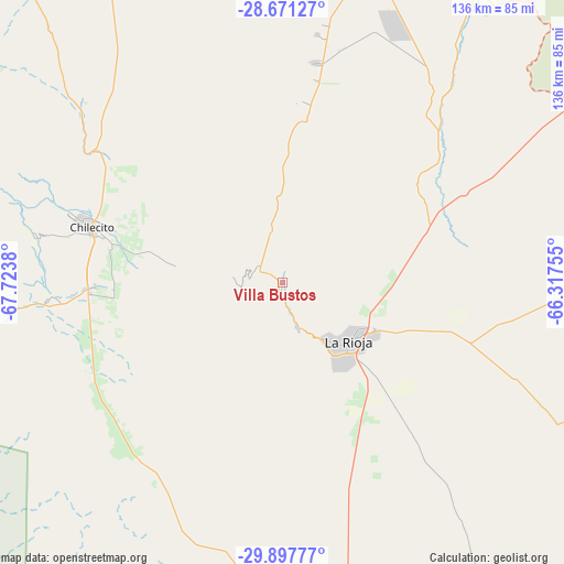
Villa Bustos GPS coordinates[2]
29° 17' 10.896" South, 67° 1' 14.412" West
| Map corner | latitude | longitude |
|---|---|---|
| Upper-left | -28.67127°, | -67.7238° |
| Center: | -29.28636°, | -67.02067° |
| Lower-right: | -29.89777°, | -66.31755° |
| Map W x H: | 136.4×136.4 km | = 84.8×84.8mi |
| max Lat: | -21.94467° ⇑32.7% North |
| Villa Bustos: | -29.28636° |
| min Lat: | ⇓67.3% South -54.81084° |
| min Long | Villa Bustos | max Long |
| -72.88605° | -67.02067° | -53.64581° |
| W 13.9%⇐ | ⇒86.1% E |
Elevation
Elevation of Villa Bustos is 989 m = 3245 ft, and this is 639.7 m = 2099 ft above average elevation for this country.
| Max E: |
4040 m = 13255 ft | 7.8% |
| Villa Bustos | 989 m 3245 ft | |
| Avg. | 349.3 m = 1146 ft | |
Min E: |
-2 m = -7 ft | 92.2% |
See also: Argentina elevation on elevation.city.
Geographical zone
Villa Bustos is located in South temperate zone (between Tropic of Capricorn and the Antarctic Circle). Distance of this Southern Tropic circle is 650.4 km =404.1 mi to North.| Distance of | km | miles | from Villa Bustos |
|---|---|---|---|
| Equator | 3256.3 | 2023.4 | to North |
| Tropic Capricorn | 650.4 | 404.1 | to North |
| Antarctic Circle | 4144.8 | 2575.5 | to South |
| South Pole | 6750.7 | 4194.7 | to South |


Nearby cities:
15 places around Villa Bustos: (largest is in red/bold)
• Aimogasta
83.3 km =51.8 mi,  14°
14°
• Aminga
49.6 km =30.8 mi, 10°
• Arauco
81.5 km =50.6 mi,  15°
15°
• Capayán
110.4 km =68.6 mi,  58°
58°
• Chilecito
48.3 km =30 mi,  286°
286°
• Chumbicha
90.2 km =56 mi, 57°
• Famatina
63.2 km =39.3 mi,  309°
309°
• Huillapima
119 km =73.9 mi, 58°
• La Rioja
21.5 km =13.4 mi,  130°
130°
• Patquía
85.6 km =53.2 mi,  171°
171°
• Pomán
126.1 km =78.4 mi,  38°
38°
• San Blas de los Sauces
97.6 km =60.6 mi,  355°
355°
• Sañogasta
23.2 km =14.4 mi,  336°
336°
• Villa Castelli
120.6 km =74.9 mi,  284°
284°
• Villa Unión
117 km =72.7 mi,  268°
268°
Sources, notices
• [Note1] Compared only with cities in Argentina existing in our database
• [Src1] Map data: © OpenStreetMap contributors (CC-BY-SA)
• [Src2] Other city data from geonames.org with taken over terms of usage.
• [Src3] Geographical zone / Annual Mean Temperature by Robert A. Rohde @ Wikipedia
