Lonquimay geodata
Lonquimay (La Pampa) is a populated place; located in Argentina in America/Argentina/Salta (GMT-3) time zone. With population of 1,672 people, there are 675 cities with bigger population in this country. Compared to other cities in Argentina, 83.5% of cities are located further ↑North; 57.1% of cities are located further →East and 50.4% of cities have higher elevation than Lonquimay. Note1


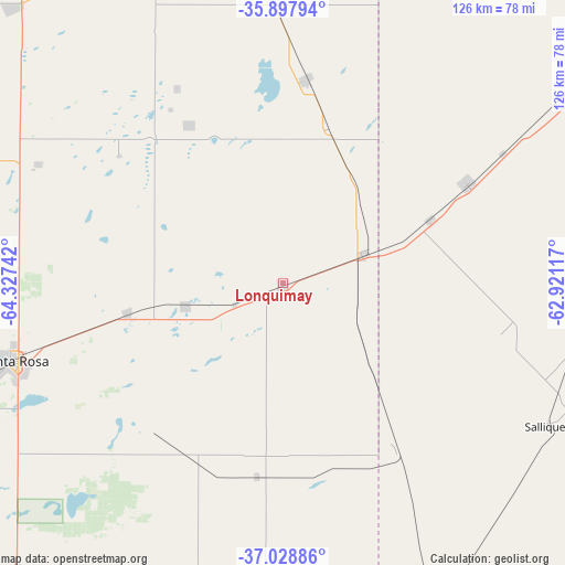
Lonquimay GPS coordinates[2]
36° 27' 55.656" South, 63° 37' 27.444" West
| Map corner | latitude | longitude |
|---|---|---|
| Upper-left | -35.89794°, | -64.32742° |
| Center: | -36.46546°, | -63.62429° |
| Lower-right: | -37.02886°, | -62.92117° |
| Map W x H: | 125.7×125.7 km | = 78.1×78.1mi |
| max Lat: | -21.94467° ⇑83.5% North |
| Lonquimay: | -36.46546° |
| min Lat: | ⇓16.5% South -54.81084° |
| min Long | Lonquimay | max Long |
| -72.88605° | -63.62429° | -53.64581° |
| W 42.9%⇐ | ⇒57.1% E |
Elevation
Elevation of Lonquimay is 142 m = 466 ft, and this is 207.3 m = 680 ft below average elevation for this country.
| Max E: |
4040 m = 13255 ft | 50.4% |
| Avg. | 349.3 m = 1146 ft | |
| Lonquimay | 142 m = 466 ft | |
Min E: |
-2 m = -7 ft | 49.6% |
See also: Argentina elevation on elevation.city.
Geographical zone
Lonquimay is located in South temperate zone (between Tropic of Capricorn and the Antarctic Circle). Distance of this Southern Tropic circle is 1448.7 km =900.2 mi to North.| Distance of | km | miles | from Lonquimay |
|---|---|---|---|
| Equator | 4054.6 | 2519.4 | to North |
| Tropic Capricorn | 1448.7 | 900.2 | to North |
| Antarctic Circle | 3346.6 | 2079.5 | to South |
| South Pole | 5952.5 | 3698.7 | to South |


Nearby cities:
15 places around Lonquimay: (largest is in red/bold)
• Anguil
35.1 km =21.8 mi,  259°
259°
• Catriló
19.3 km =12 mi,  69°
69°
• Colonia Barón
40.5 km =25.2 mi,  329°
329°
• Doblas
83.5 km =51.9 mi,  204°
204°
• Eduardo Castex
85.8 km =53.3 mi,  315°
315°
• Macachín
74.6 km =46.4 mi,  182°
182°
• Miguel Riglos
43.6 km =27.1 mi,  187°
187°
• Pellegrini
46.7 km =29 mi,  61°
61°
• Quemú Quemú
46 km =28.6 mi,  6°
6°
• Salliqueló
67.3 km =41.8 mi,  118°
118°
• Santa Rosa
61.2 km =38 mi,  254°
254°
• Toay
71.2 km =44.2 mi, 251°
• Tres Lomas
68.3 km =42.4 mi,  89°
89°
• Uriburu
21.8 km =13.5 mi, 257°
• Winifreda
60.7 km =37.7 mi,  295°
295°
Sources, notices
• [Note1] Compared only with cities in Argentina existing in our database
• [Src1] Map data: © OpenStreetMap contributors (CC-BY-SA)
• [Src2] Other city data from geonames.org with taken over terms of usage.
• [Src3] Geographical zone / Annual Mean Temperature by Robert A. Rohde @ Wikipedia
