Santa Rosa geodata
Santa Rosa (La Pampa) is a seat of a first-order administrative division; located in Argentina in America/Argentina/Salta (GMT-3) time zone. With population of 111,424 people, there are 36 cities with bigger population in this country. Compared to other cities in Argentina, 84.1% of cities are located further ↑North; 64.4% of cities are located further →East and 56.1% of cities have lower elevation than Santa Rosa. Note1


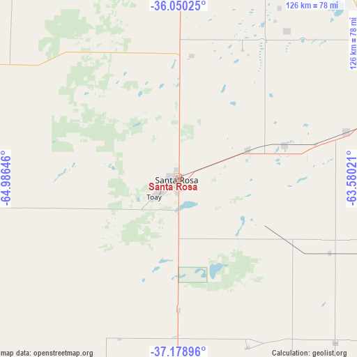
Santa Rosa GPS coordinates[2]
36° 37' 0.012" South, 64° 16' 59.988" West
| Map corner | latitude | longitude |
|---|---|---|
| Upper-left | -36.05025°, | -64.98646° |
| Center: | -36.61667°, | -64.28333° |
| Lower-right: | -37.17896°, | -63.58021° |
| Map W x H: | 125.5×125.5 km | = 78×78mi |
| max Lat: | -21.94467° ⇑84.1% North |
| Santa Rosa: | -36.61667° |
| min Lat: | ⇓15.9% South -54.81084° |
| min Long | Santa Rosa | max Long |
| -72.88605° | -64.28333° | -53.64581° |
| W 35.6%⇐ | ⇒64.4% E |
Elevation
Elevation of Santa Rosa is 179 m = 587 ft, and this is 170.3 m = 559 ft below average elevation for this country.
| Max E: |
4040 m = 13255 ft | 43.9% |
| Avg. | 349.3 m = 1146 ft | |
| Santa Rosa | 179 m = 587 ft | |
Min E: |
-2 m = -7 ft | 56.1% |
See also: Santa Rosa elevation on elevation.city.
Geographical zone
Santa Rosa is located in South temperate zone (between Tropic of Capricorn and the Antarctic Circle). Distance of this Southern Tropic circle is 1465.5 km =910.6 mi to North.| Distance of | km | miles | from Santa Rosa |
|---|---|---|---|
| Equator | 4071.4 | 2529.8 | to North |
| Tropic Capricorn | 1465.5 | 910.6 | to North |
| Antarctic Circle | 3329.8 | 2069 | to South |
| South Pole | 5935.7 | 3688.3 | to South |


Nearby cities:
15 places around Santa Rosa: (largest is in red/bold)
• Alpachiri
95.9 km =59.6 mi,  151°
151°
• Anguil
26.4 km =16.4 mi,  67°
67°
• Ataliva Roca
46.1 km =28.6 mi,  180°
180°
• Catriló
80.5 km =50 mi, 73°
• Colonia Barón
64.4 km =40 mi,  36°
36°
• Doblas
64 km =39.8 mi,  157°
157°
• Eduardo Castex
78 km =48.5 mi,  359°
359°
• General Acha
89.2 km =55.4 mi,  198°
198°
• Lonquimay
61.2 km =38 mi, 74°
• Macachín
79.6 km =49.5 mi,  136°
136°
• Miguel Riglos
59.2 km =36.8 mi,  116°
116°
• Quemú Quemú
89.7 km =55.7 mi,  45°
45°
• Toay
10.6 km =6.6 mi,  233°
233°
• Uriburu
39.5 km =24.5 mi, 72°
• Winifreda
43.6 km =27.1 mi,  5°
5°
In other languages:
- In Spanish: Ciudad de Santa Rosa
- In German: Santa Rosa de Toay
- In Russian: Санта-Роса
- In Chinese: 聖羅莎
Sources, notices
• [Note1] Compared only with cities in Argentina existing in our database
• [Src1] Map data: © OpenStreetMap contributors (CC-BY-SA)
• [Src2] Other city data from geonames.org with taken over terms of usage.
• [Src3] Geographical zone / Annual Mean Temperature by Robert A. Rohde @ Wikipedia
