Tres Lomas geodata
Tres Lomas (Buenos Aires) is a seat of a second-order administrative division; located in Argentina in America/Argentina/Buenos_Aires (GMT-3) time zone. In our database, there are 785 cities with bigger population. Compared to other cities in Argentina, 83.4% of cities are located further ↑North; 51.1% of cities are located further →East and 57% of cities have higher elevation than Tres Lomas. Note1


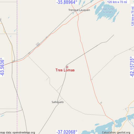
Tres Lomas GPS coordinates[2]
36° 27' 25.992" South, 62° 51' 37.692" West
| Map corner | latitude | longitude |
|---|---|---|
| Upper-left | -35.88964°, | -63.5636° |
| Center: | -36.45722°, | -62.86047° |
| Lower-right: | -37.02068°, | -62.15735° |
| Map W x H: | 125.8×125.8 km | = 78.2×78.2mi |
| max Lat: | -21.94467° ⇑83.4% North |
| Tres Lomas: | -36.45722° |
| min Lat: | ⇓16.6% South -54.81084° |
| min Long | Tres Lomas | max Long |
| -72.88605° | -62.86047° | -53.64581° |
| W 48.9%⇐ | ⇒51.1% E |
Elevation
Elevation of Tres Lomas is 116 m = 381 ft, and this is 233.3 m = 765 ft below average elevation for this country.
| Max E: |
4040 m = 13255 ft | 57% |
| Avg. | 349.3 m = 1146 ft | |
| Tres Lomas | 116 m = 381 ft | |
Min E: |
-2 m = -7 ft | 43% |
See also: Argentina elevation on elevation.city.
Geographical zone
Tres Lomas is located in South temperate zone (between Tropic of Capricorn and the Antarctic Circle). Distance of this Southern Tropic circle is 1447.7 km =899.6 mi to North.| Distance of | km | miles | from Tres Lomas |
|---|---|---|---|
| Equator | 4053.7 | 2518.9 | to North |
| Tropic Capricorn | 1447.7 | 899.6 | to North |
| Antarctic Circle | 3347.5 | 2080 | to South |
| South Pole | 5953.4 | 3699.3 | to South |


Nearby cities:
15 places around Tres Lomas: (largest is in red/bold)
• Anguil
103.1 km =64.1 mi,  265°
265°
• Carhué
80.5 km =50 mi,  173°
173°
• Catriló
50.5 km =31.4 mi,  276°
276°
• Colonia Barón
95.3 km =59.2 mi,  290°
290°
• Daireaux
100.5 km =62.4 mi,  99°
99°
• Guaminí
73.4 km =45.6 mi,  147°
147°
• Henderson
103.9 km =64.6 mi,  80°
80°
• Lonquimay
68.3 km =42.4 mi, 269°
• Macachín
104.1 km =64.7 mi,  223°
223°
• Miguel Riglos
86 km =53.4 mi,  239°
239°
• Pellegrini
34.6 km =21.5 mi,  307°
307°
• Quemú Quemú
77.4 km =48.1 mi, 305°
• Salliqueló
34 km =21.1 mi,  195°
195°
• Trenque Lauquen
55.3 km =34.4 mi,  11°
11°
• Uriburu
89.7 km =55.7 mi, 266°
Sources, notices
• [Note1] Compared only with cities in Argentina existing in our database
• [Src1] Map data: © OpenStreetMap contributors (CC-BY-SA)
• [Src2] Other city data from geonames.org with taken over terms of usage.
• [Src3] Geographical zone / Annual Mean Temperature by Robert A. Rohde @ Wikipedia
