Voitsberg geodata
Voitsberg (Styria) is a seat of a third-order administrative division; located in Austria in Europe/Vienna (GMT+2) time zone. With population of 9,403 people, there are 86 cities with bigger population in this country. Compared to other cities in Austria, 82.4% of cities are located further ↑North; 56.8% of cities are located further ←West and 56.3% of cities have higher elevation than Voitsberg. Note1
Administrative division(s):
- Level 1: Styria
- Level 2: Politischer Bezirk Voitsberg
- Level 3: Voitsberg


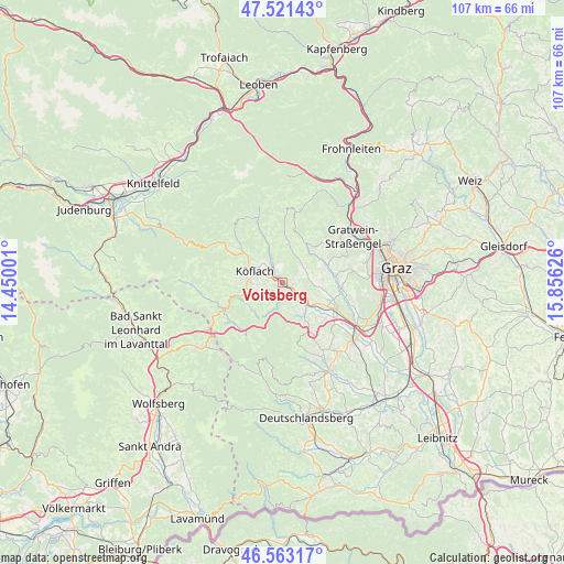
Voitsberg GPS coordinates[2]
47° 2' 40.02" North, 15° 9' 11.268" East
| Map corner | latitude | longitude |
|---|---|---|
| Upper-left | 47.52143°, | 14.45001° |
| Center: | 47.04445°, | 15.15313° |
| Lower-right: | 46.56317°, | 15.85626° |
| Map W x H: | 106.5×106.5 km | = 66.2×66.2mi |
| max Lat: | 48.98333° ⇑82.4% North |
| Voitsberg: | 47.04445° |
| min Lat: | ⇓17.6% South 46.48841° |
| min Long | Voitsberg | max Long |
| 9.57802° | 15.15313° | 17.1° |
| W 56.8%⇐ | ⇒43.2% E |
Elevation
Elevation of Voitsberg is 410 m = 1345 ft, and this is 95.5 m = 313 ft below average elevation for this country.
| Max E: |
2140 m = 7021 ft | 56.3% |
| Avg. | 505.5 m = 1658 ft | |
| Voitsberg | 410 m = 1345 ft | |
Min E: |
118 m = 387 ft | 43.7% |
See also: Austria elevation on elevation.city.
Geographical zone
Voitsberg is located in North temperate zone (between Tropic of Cancer and the Arctic Circle). Distance of this North polar circle is 2170.3 km =1348.6 mi to North.| Distance of | km | miles | from Voitsberg |
|---|---|---|---|
| North Pole | 4776.2 | 2967.8 | to North |
| Arctic Circle | 2170.3 | 1348.6 | to North |
| Tropic Cancer | 2624.9 | 1631 | to South |
| Equator | 5230.9 | 3250.3 | to South |


Nearby cities:
15 places around Voitsberg: (largest is in red/bold)
• Bärnbach
3.6 km =2.2 mi,  327°
327°
• Dietenberg
7.4 km =4.6 mi,  135°
135°
• Gradenberg
7.3 km =4.5 mi,  300°
300°
• Hochtregist
6.4 km =4 mi,  346°
346°
• Kleingaisfeld
4.8 km =3 mi,  116°
116°
• Krottendorf bei Ligist
5.7 km =3.5 mi, 122°
• Köflach
5.8 km =3.6 mi, 295°
• Ligist
7.1 km =4.4 mi, 142°
• Maria Lankowitz
6.9 km =4.3 mi,  286°
286°
• Piberegg
6.2 km =3.9 mi, 333°
• Pichling bei Köflach
6.2 km =3.9 mi,  273°
273°
• Rosental an der Kainach
2.5 km =1.6 mi, 289°
• Stallhofen
4.9 km =3 mi,  82°
82°
• Stiwoll
7.8 km =4.8 mi,  37°
37°
• Södingberg
7.1 km =4.4 mi,  11°
11°
Sources, notices
• [Note1] Compared only with cities in Austria existing in our database
• [Src1] Map data: © OpenStreetMap contributors (CC-BY-SA)
• [Src2] Other city data from geonames.org with taken over terms of usage.
• [Src3] Geographical zone / Annual Mean Temperature by Robert A. Rohde @ Wikipedia
