Altenburg geodata
Altenburg (Lower Austria) is a seat of a third-order administrative division; located in Austria in Europe/Vienna (GMT+2) time zone. With population of 439 people, there are 2577 cities with bigger population in this country. Compared to other cities in Austria, 97.3% of cities are located further ↓South; 68.4% of cities are located further ←West and 59.4% of cities have higher elevation than Altenburg. Note1
Administrative division(s):
- Level 1: Lower Austria
- Level 2: Politischer Bezirk Horn
- Level 3: Altenburg


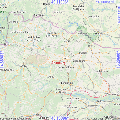
Altenburg GPS coordinates[2]
48° 38' 51.54" North, 15° 35' 34.62" East
| Map corner | latitude | longitude |
|---|---|---|
| Upper-left | 49.11006°, | 14.88983° |
| Center: | 48.64765°, | 15.59295° |
| Lower-right: | 48.18096°, | 16.29608° |
| Map W x H: | 103.3×103.3 km | = 64.2×64.2mi |
| max Lat: | 48.98333° ⇑2.7% North |
| Altenburg: | 48.64765° |
| min Lat: | ⇓97.3% South 46.48841° |
| min Long | Altenburg | max Long |
| 9.57802° | 15.59295° | 17.1° |
| W 68.4%⇐ | ⇒31.6% E |
Elevation
Elevation of Altenburg is 389 m = 1276 ft, and this is 116.5 m = 382 ft below average elevation for this country.
| Max E: |
2140 m = 7021 ft | 59.4% |
| Avg. | 505.5 m = 1658 ft | |
| Altenburg | 389 m = 1276 ft | |
Min E: |
118 m = 387 ft | 40.6% |
See also: Austria elevation on elevation.city.
Geographical zone
Altenburg is located in North temperate zone (between Tropic of Cancer and the Arctic Circle). Distance of this North polar circle is 1992.1 km =1237.8 mi to North.| Distance of | km | miles | from Altenburg |
|---|---|---|---|
| North Pole | 4598 | 2857.1 | to North |
| Arctic Circle | 1992.1 | 1237.8 | to North |
| Tropic Cancer | 2803.2 | 1741.8 | to South |
| Equator | 5409.1 | 3361.1 | to South |


Nearby cities:
15 places around Altenburg: (largest is in red/bold)
• Brunn an der Wild
7.4 km =4.6 mi,  314°
314°
• Frauenhofen
3.8 km =2.4 mi,  42°
42°
• Gars am Kamp
7.9 km =4.9 mi,  145°
145°
• Göpfritz an der Wild
16.4 km =10.2 mi,  301°
301°
• Horn
5 km =3.1 mi,  70°
70°
• Jaidhof
15.1 km =9.4 mi,  212°
212°
• Japons
16.2 km =10.1 mi,  353°
353°
• Krumau am Kamp
12.4 km =7.7 mi,  238°
238°
• Pernegg
9.7 km =6 mi,  10°
10°
• Röhrenbach
6.8 km =4.2 mi,  272°
272°
• Röschitz
16.5 km =10.3 mi,  91°
91°
• Sankt Leonhard am Hornerwald
6.9 km =4.3 mi,  219°
219°
• Schiltern
14.7 km =9.1 mi,  173°
173°
• Sigmundsherberg
12.2 km =7.6 mi, 71°
• Wolfshoferamt
5.6 km =3.5 mi,  200°
200°
Sources, notices
• [Note1] Compared only with cities in Austria existing in our database
• [Src1] Map data: © OpenStreetMap contributors (CC-BY-SA)
• [Src2] Other city data from geonames.org with taken over terms of usage.
• [Src3] Geographical zone / Annual Mean Temperature by Robert A. Rohde @ Wikipedia
