Wolfshoferamt geodata
Wolfshoferamt (Lower Austria) is a populated place; located in Austria in Europe/Vienna (GMT+2) time zone. With population of 510 people, there are 2471 cities with bigger population in this country. Compared to other cities in Austria, 96.6% of cities are located further ↓South; 67.2% of cities are located further ←West and 60.4% of cities have lower elevation than Wolfshoferamt. Note1
Administrative division(s):
- Level 1: Lower Austria
- Level 2: Politischer Bezirk Krems
- Level 3: St. Leonhard am Hornerwald


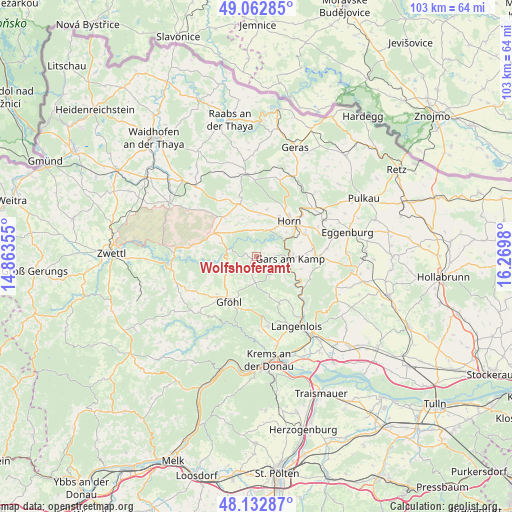
Wolfshoferamt GPS coordinates[2]
48° 36' 0" North, 15° 34' 0.012" East
| Map corner | latitude | longitude |
|---|---|---|
| Upper-left | 49.06285°, | 14.86355° |
| Center: | 48.6°, | 15.56667° |
| Lower-right: | 48.13287°, | 16.2698° |
| Map W x H: | 103.4×103.4 km | = 64.2×64.2mi |
| max Lat: | 48.98333° ⇑3.4% North |
| Wolfshoferamt: | 48.6° |
| min Lat: | ⇓96.6% South 46.48841° |
| min Long | Wolfshoferamt | max Long |
| 9.57802° | 15.56667° | 17.1° |
| W 67.2%⇐ | ⇒32.8% E |
Elevation
Elevation of Wolfshoferamt is 520 m = 1706 ft, and this is 14.5 m = 48 ft above average elevation for this country.
| Max E: |
2140 m = 7021 ft | 39.6% |
| Wolfshoferamt | 520 m 1706 ft | |
| Avg. | 505.5 m = 1658 ft | |
Min E: |
118 m = 387 ft | 60.4% |
See also: Austria elevation on elevation.city.
Geographical zone
Wolfshoferamt is located in North temperate zone (between Tropic of Cancer and the Arctic Circle). Distance of this North polar circle is 1997.4 km =1241.1 mi to North.| Distance of | km | miles | from Wolfshoferamt |
|---|---|---|---|
| North Pole | 4603.2 | 2860.3 | to North |
| Arctic Circle | 1997.4 | 1241.1 | to North |
| Tropic Cancer | 2797.9 | 1738.5 | to South |
| Equator | 5403.8 | 3357.8 | to South |


Nearby cities:
15 places around Wolfshoferamt: (largest is in red/bold)
• Altenburg
5.6 km =3.5 mi,  20°
20°
• Brunn an der Wild
11 km =6.8 mi,  341°
341°
• Droß
15.1 km =9.4 mi,  177°
177°
• Frauenhofen
9.3 km =5.8 mi,  29°
29°
• Gars am Kamp
6.5 km =4 mi,  100°
100°
• Gföhl
11.1 km =6.9 mi,  213°
213°
• Horn
9.6 km =6 mi,  43°
43°
• Jaidhof
9.6 km =6 mi,  219°
219°
• Krumau am Kamp
8.7 km =5.4 mi,  261°
261°
• Lengenfeld
14.4 km =8.9 mi,  170°
170°
• Pernegg
15.3 km =9.5 mi,  13°
13°
• Röhrenbach
7.4 km =4.6 mi,  318°
318°
• Sankt Leonhard am Hornerwald
2.5 km =1.6 mi,  270°
270°
• Schiltern
10 km =6.2 mi,  158°
158°
• Schönberg
13.5 km =8.4 mi,  133°
133°
Sources, notices
• [Note1] Compared only with cities in Austria existing in our database
• [Src1] Map data: © OpenStreetMap contributors (CC-BY-SA)
• [Src2] Other city data from geonames.org with taken over terms of usage.
• [Src3] Geographical zone / Annual Mean Temperature by Robert A. Rohde @ Wikipedia
