Raabs an der Thaya geodata
Raabs an der Thaya (Lower Austria) is a seat of a third-order administrative division; located in Austria in Europe/Vienna (GMT+2) time zone. With population of 807 people, there are 1597 cities with bigger population in this country. Compared to other cities in Austria, 99.5% of cities are located further ↓South; 65.5% of cities are located further ←West and 50.6% of cities have higher elevation than Raabs an der Thaya. Note1
Administrative division(s):
- Level 1: Lower Austria
- Level 2: Politischer Bezirk Waidhofen an der Thaya
- Level 3: Raabs an der Thaya


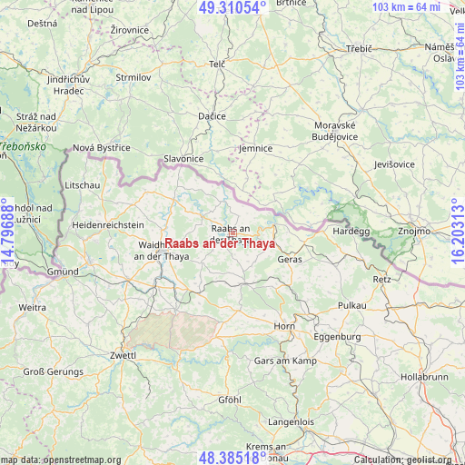
Raabs an der Thaya GPS coordinates[2]
48° 51' 0" North, 15° 30' 0" East
| Map corner | latitude | longitude |
|---|---|---|
| Upper-left | 49.31054°, | 14.79688° |
| Center: | 48.85°, | 15.5° |
| Lower-right: | 48.38518°, | 16.20313° |
| Map W x H: | 102.9×102.9 km | = 63.9×63.9mi |
| max Lat: | 48.98333° ⇑0.5% North |
| Raabs an der Thaya: | 48.85° |
| min Lat: | ⇓99.5% South 46.48841° |
| min Long | Raabs an der Th | max Long |
| 9.57802° | 15.5° | 17.1° |
| W 65.5%⇐ | ⇒34.5% E |
Elevation
Elevation of Raabs an der Thaya is 447 m = 1467 ft, and this is 58.5 m = 192 ft below average elevation for this country.
| Max E: |
2140 m = 7021 ft | 50.6% |
| Avg. | 505.5 m = 1658 ft | |
| Raabs an der Thaya | 447 m = 1467 ft | |
Min E: |
118 m = 387 ft | 49.4% |
See also: Austria elevation on elevation.city.
Geographical zone
Raabs an der Thaya is located in North temperate zone (between Tropic of Cancer and the Arctic Circle). Distance of this North polar circle is 1969.6 km =1223.9 mi to North.| Distance of | km | miles | from Raabs an der Thaya |
|---|---|---|---|
| North Pole | 4575.5 | 2843.1 | to North |
| Arctic Circle | 1969.6 | 1223.9 | to North |
| Tropic Cancer | 2825.7 | 1755.8 | to South |
| Equator | 5431.6 | 3375 | to South |


Nearby cities:
15 places around Raabs an der Thaya: (largest is in red/bold)
• Alt-Dietmanns
10.6 km =6.6 mi,  233°
233°
• Brunn an der Wild
17.4 km =10.8 mi,  175°
175°
• Dobersberg
14.9 km =9.3 mi,  299°
299°
• Drosendorf
9.1 km =5.7 mi,  77°
77°
• Geras
13.9 km =8.6 mi,  114°
114°
• Groß-Siegharts
9.5 km =5.9 mi, 227°
• Göpfritz an der Wild
15.6 km =9.7 mi,  207°
207°
• Japons
8.1 km =5 mi,  141°
141°
• Karlstein
8.2 km =5.1 mi, 296°
• Langau
15.9 km =9.9 mi,  97°
97°
• Pernegg
15.5 km =9.6 mi,  146°
146°
• Thaya
15.4 km =9.6 mi,  272°
272°
• Waidhofen an der Thaya
16.3 km =10.1 mi,  256°
256°
• Waldkirchen an der Thaya
14.4 km =8.9 mi,  310°
310°
• Windigsteig
18.4 km =11.4 mi,  239°
239°
Sources, notices
• [Note1] Compared only with cities in Austria existing in our database
• [Src1] Map data: © OpenStreetMap contributors (CC-BY-SA)
• [Src2] Other city data from geonames.org with taken over terms of usage.
• [Src3] Geographical zone / Annual Mean Temperature by Robert A. Rohde @ Wikipedia
