Pabneukirchen geodata
Pabneukirchen (Upper Austria) is a seat of a third-order administrative division; located in Austria in Europe/Vienna (GMT+2) time zone. With population of 497 people, there are 2514 cities with bigger population in this country. Compared to other cities in Austria, 86.9% of cities are located further ↓South; 51.8% of cities are located further ←West and 69.4% of cities have lower elevation than Pabneukirchen. Note1
Administrative division(s):
- Level 1: Upper Austria
- Level 2: Politischer Bezirk Perg
- Level 3: Pabneukirchen


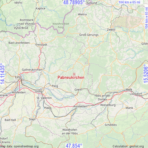
Pabneukirchen GPS coordinates[2]
48° 19' 25.212" North, 14° 49' 2.892" East
| Map corner | latitude | longitude |
|---|---|---|
| Upper-left | 48.78905°, | 14.11435° |
| Center: | 48.32367°, | 14.81747° |
| Lower-right: | 47.854°, | 15.5206° |
| Map W x H: | 104×104 km | = 64.6×64.6mi |
| max Lat: | 48.98333° ⇑13.1% North |
| Pabneukirchen: | 48.32367° |
| min Lat: | ⇓86.9% South 46.48841° |
| min Long | Pabneukirchen | max Long |
| 9.57802° | 14.81747° | 17.1° |
| W 51.8%⇐ | ⇒48.2% E |
Elevation
Elevation of Pabneukirchen is 583 m = 1913 ft, and this is 77.5 m = 254 ft above average elevation for this country.
| Max E: |
2140 m = 7021 ft | 30.6% |
| Pabneukirchen | 583 m 1913 ft | |
| Avg. | 505.5 m = 1658 ft | |
Min E: |
118 m = 387 ft | 69.4% |
See also: Austria elevation on elevation.city.
Geographical zone
Pabneukirchen is located in North temperate zone (between Tropic of Cancer and the Arctic Circle). Distance of this North polar circle is 2028.1 km =1260.2 mi to North.| Distance of | km | miles | from Pabneukirchen |
|---|---|---|---|
| North Pole | 4634 | 2879.4 | to North |
| Arctic Circle | 2028.1 | 1260.2 | to North |
| Tropic Cancer | 2767.2 | 1719.5 | to South |
| Equator | 5373.1 | 3338.7 | to South |


Nearby cities:
15 places around Pabneukirchen: (largest is in red/bold)
• Allerheiligen im Mühlkreis
12.6 km =7.8 mi,  259°
259°
• Bad Kreuzen
6.3 km =3.9 mi,  187°
187°
• Bad Zell
11.3 km =7 mi,  284°
284°
• Dorfstetten
12.2 km =7.6 mi,  88°
88°
• Grein
11 km =6.8 mi,  163°
163°
• Königswiesen
9.1 km =5.7 mi,  9°
9°
• Mönchdorf
4.4 km =2.7 mi,  337°
337°
• Münzbach
10.1 km =6.3 mi,  231°
231°
• Pierbach
5.3 km =3.3 mi,  300°
300°
• Sankt Georgen am Walde
7.4 km =4.6 mi,  57°
57°
• Saxen
13 km =8.1 mi, 188°
• Schönau im Mühlkreis
10.2 km =6.3 mi,  320°
320°
• Unterweissenbach
12.7 km =7.9 mi,  348°
348°
• Waldhausen im Strudengau
11.1 km =6.9 mi,  119°
119°
• Windhaag bei Perg
10.9 km =6.8 mi,  247°
247°
Sources, notices
• [Note1] Compared only with cities in Austria existing in our database
• [Src1] Map data: © OpenStreetMap contributors (CC-BY-SA)
• [Src2] Other city data from geonames.org with taken over terms of usage.
• [Src3] Geographical zone / Annual Mean Temperature by Robert A. Rohde @ Wikipedia
