Kimba geodata
Kimba (South Australia) is a populated place; located in Australia in Australia/Adelaide (GMT+10.5) time zone. With population of 666 people, there are 4391 cities with bigger population in this country. Compared to other cities in Australia, 56.5% of cities are located further ↓South; 86.1% of cities are located further →East and 86.3% of cities have lower elevation than Kimba. Note1


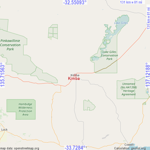
Kimba GPS coordinates[2]
33° 8' 29.904" South, 136° 25' 7.5" East
| Map corner | latitude | longitude |
|---|---|---|
| Upper-left | -32.55093°, | 135.71563° |
| Center: | -33.14164°, | 136.41875° |
| Lower-right: | -33.7284°, | 137.12188° |
| Map W x H: | 130.9×130.9 km | = 81.3×81.3mi |
| max Lat: | -10.58257° ⇑43.5% North |
| Kimba: | -33.14164° |
| min Lat: | ⇓56.5% South -43.31423° |
| min Long | Kimba | max Long |
| 113.53327° | 136.41875° | 153.61246° |
| W 13.9%⇐ | ⇒86.1% E |
Elevation
Elevation of Kimba is 271 m = 889 ft, and this is 149 m = 489 ft above average elevation for this country.
| Max E: |
1715 m = 5627 ft | 13.7% |
| Kimba | 271 m 889 ft | |
| Avg. | 122 m = 400 ft | |
Min E: |
-2 m = -7 ft | 86.3% |
See also: Australia elevation on elevation.city.
Geographical zone
Kimba is located in South temperate zone (between Tropic of Capricorn and the Antarctic Circle). Distance of this Southern Tropic circle is 1079.1 km =670.5 mi to North.| Distance of | km | miles | from Kimba |
|---|---|---|---|
| Equator | 3685 | 2289.8 | to North |
| Tropic Capricorn | 1079.1 | 670.5 | to North |
| Antarctic Circle | 3716.2 | 2309.1 | to South |
| South Pole | 6322.1 | 3928.4 | to South |


Nearby cities:
15 places around Kimba: (largest is in red/bold)
• Arno Bay
85.4 km =53.1 mi,  170°
170°
• Cleve
62.5 km =38.8 mi, 173°
• Cowell
76.1 km =47.3 mi,  142°
142°
• Cummins
140.3 km =87.2 mi,  207°
207°
• Moonta Bay
146.6 km =91.1 mi,  133°
133°
• Port Augusta
145.5 km =90.4 mi,  60°
60°
• Port Augusta West
144.9 km =90 mi, 59°
• Tumby Bay
140.5 km =87.3 mi,  192°
192°
• Wallaroo
143.3 km =89 mi, 128°
• Whyalla
107.5 km =66.8 mi,  83°
83°
• Whyalla Jenkins
102.8 km =63.9 mi, 82°
• Whyalla Norrie
105.1 km =65.3 mi, 83°
• Whyalla Playford
107.3 km =66.7 mi, 83°
• Whyalla Stuart
103.8 km =64.5 mi, 82°
• Wudinna
89.5 km =55.6 mi,  276°
276°
Sources, notices
• [Note1] Compared only with cities in Australia existing in our database
• [Src1] Map data: © OpenStreetMap contributors (CC-BY-SA)
• [Src2] Other city data from geonames.org with taken over terms of usage.
• [Src3] Geographical zone / Annual Mean Temperature by Robert A. Rohde @ Wikipedia
