Esperance geodata
Esperance (Western Australia) is a populated place; located in Australia in Australia/Perth (GMT+8) time zone. With population of 2,263 people, there are 2720 cities with bigger population in this country. Compared to other cities in Australia, 54% of cities are located further ↑North; 88.9% of cities are located further →East and 88.3% of cities have higher elevation than Esperance. Note1


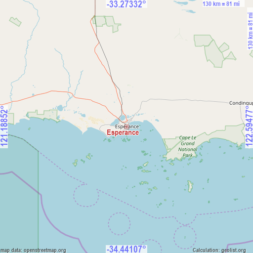
Esperance GPS coordinates[2]
33° 51' 33.084" South, 121° 53' 29.904" East
| Map corner | latitude | longitude |
|---|---|---|
| Upper-left | -33.27332°, | 121.18852° |
| Center: | -33.85919°, | 121.89164° |
| Lower-right: | -34.44107°, | 122.59477° |
| Map W x H: | 129.8×129.8 km | = 80.7×80.7mi |
| max Lat: | -10.58257° ⇑54% North |
| Esperance: | -33.85919° |
| min Lat: | ⇓46% South -43.31423° |
| min Long | Esperance | max Long |
| 113.53327° | 121.89164° | 153.61246° |
| W 11.1%⇐ | ⇒88.9% E |
Elevation
Elevation of Esperance is 10 m = 33 ft, and this is 112 m = 367 ft below average elevation for this country.
| Max E: |
1715 m = 5627 ft | 88.3% |
| Avg. | 122 m = 400 ft | |
| Esperance | 10 m = 33 ft | |
Min E: |
-2 m = -7 ft | 11.7% |
See also: Australia elevation on elevation.city.
Geographical zone
Esperance is located in South temperate zone (between Tropic of Capricorn and the Antarctic Circle). Distance of this Southern Tropic circle is 1158.9 km =720.1 mi to North.| Distance of | km | miles | from Esperance |
|---|---|---|---|
| Equator | 3764.8 | 2339.3 | to North |
| Tropic Capricorn | 1158.9 | 720.1 | to North |
| Antarctic Circle | 3636.4 | 2259.6 | to South |
| South Pole | 6242.3 | 3878.8 | to South |


Nearby cities:
15 places around Esperance: (largest is in red/bold)
• Boulder
344.2 km =213.9 mi,  353°
353°
• Broadwood
343.7 km =213.6 mi, 353°
• Castletown
3.7 km =2.3 mi,  36°
36°
• Coolgardie
330.3 km =205.2 mi, 348°
• Hopetoun
163.2 km =101.4 mi,  266°
266°
• Kambalda East
295.8 km =183.8 mi,  355°
355°
• Kambalda West
296.5 km =184.2 mi, 355°
• Lake Grace
328.7 km =204.2 mi,  284°
284°
• Norseman
185 km =115 mi, 356°
• Nulsen
1.6 km =1 mi, 279°
• Pink Lake
3.1 km =1.9 mi,  285°
285°
• Ravensthorpe
173.3 km =107.7 mi, 280°
• Sinclair
1.9 km =1.2 mi,  255°
255°
• Stoneville
332.9 km =206.9 mi, 357°
• West Beach
1.7 km =1.1 mi,  184°
184°
Sources, notices
• [Note1] Compared only with cities in Australia existing in our database
• [Src1] Map data: © OpenStreetMap contributors (CC-BY-SA)
• [Src2] Other city data from geonames.org with taken over terms of usage.
• [Src3] Geographical zone / Annual Mean Temperature by Robert A. Rohde @ Wikipedia
