Wahgunyah geodata
Wahgunyah (Victoria) is a populated place; located in Australia in Australia/Sydney (GMT+11) time zone. With population of 1,054 people, there are 3750 cities with bigger population in this country. Compared to other cities in Australia, 78.4% of cities are located further ↑North; 55.7% of cities are located further →East and 76.3% of cities have lower elevation than Wahgunyah. Note1


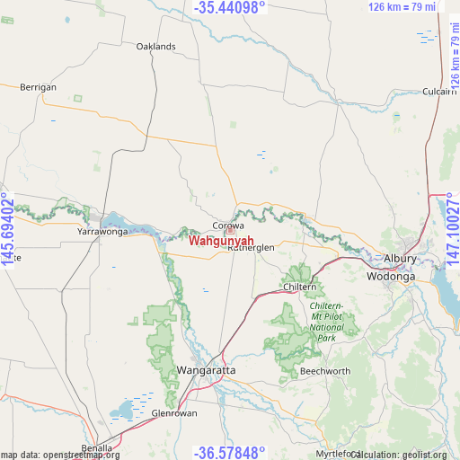
Wahgunyah GPS coordinates[2]
36° 0' 42.408" South, 146° 23' 49.704" East
| Map corner | latitude | longitude |
|---|---|---|
| Upper-left | -35.44098°, | 145.69402° |
| Center: | -36.01178°, | 146.39714° |
| Lower-right: | -36.57848°, | 147.10027° |
| Map W x H: | 126.5×126.5 km | = 78.6×78.6mi |
| max Lat: | -10.58257° ⇑78.4% North |
| Wahgunyah: | -36.01178° |
| min Lat: | ⇓21.6% South -43.31423° |
| min Long | Wahgunyah | max Long |
| 113.53327° | 146.39714° | 153.61246° |
| W 44.3%⇐ | ⇒55.7% E |
Elevation
Elevation of Wahgunyah is 141 m = 463 ft, and this is 19 m = 62 ft above average elevation for this country.
| Max E: |
1715 m = 5627 ft | 23.7% |
| Wahgunyah | 141 m 463 ft | |
| Avg. | 122 m = 400 ft | |
Min E: |
-2 m = -7 ft | 76.3% |
See also: Australia elevation on elevation.city.
Geographical zone
Wahgunyah is located in South temperate zone (between Tropic of Capricorn and the Antarctic Circle). Distance of this Southern Tropic circle is 1398.2 km =868.8 mi to North.| Distance of | km | miles | from Wahgunyah |
|---|---|---|---|
| Equator | 4004.1 | 2488 | to North |
| Tropic Capricorn | 1398.2 | 868.8 | to North |
| Antarctic Circle | 3397 | 2110.8 | to South |
| South Pole | 6002.9 | 3730 | to South |


Nearby cities:
15 places around Wahgunyah: (largest is in red/bold)
• Barnawartha
27.1 km =16.8 mi,  112°
112°
• Beechworth
46.4 km =28.8 mi,  146°
146°
• Chiltern
24.5 km =15.2 mi,  129°
129°
• Corowa
1.9 km =1.2 mi,  327°
327°
• Glenroy
46.4 km =28.8 mi,  95°
95°
• Howlong
21.4 km =13.3 mi,  81°
81°
• Jindera
44.7 km =27.8 mi, 81°
• Mulwala
35.4 km =22 mi,  274°
274°
• Rutherglen
7.5 km =4.7 mi, 128°
• Waldara
35.7 km =22.2 mi,  196°
196°
• Wangaratta
39.2 km =24.4 mi,  190°
190°
• West Albury
45.2 km =28.1 mi, 99°
• West Wodonga
42.7 km =26.5 mi, 106°
• Wodonga
45.8 km =28.5 mi, 105°
• Yarrawonga
35.8 km =22.2 mi, 268°
Sources, notices
• [Note1] Compared only with cities in Australia existing in our database
• [Src1] Map data: © OpenStreetMap contributors (CC-BY-SA)
• [Src2] Other city data from geonames.org with taken over terms of usage.
• [Src3] Geographical zone / Annual Mean Temperature by Robert A. Rohde @ Wikipedia
