Nyngan geodata
Nyngan (New South Wales) is a populated place; located in Australia in Australia/Sydney (GMT+11) time zone. With population of 2,203 people, there are 2756 cities with bigger population in this country. Compared to other cities in Australia, 69.5% of cities are located further ↓South; 52% of cities are located further →East and 79.4% of cities have lower elevation than Nyngan. Note1


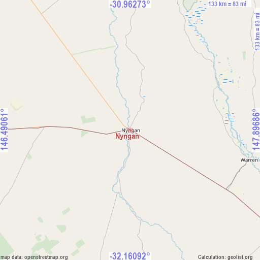
Nyngan GPS coordinates[2]
31° 33' 49.5" South, 147° 11' 37.428" East
| Map corner | latitude | longitude |
|---|---|---|
| Upper-left | -30.96273°, | 146.49061° |
| Center: | -31.56375°, | 147.19373° |
| Lower-right: | -32.16092°, | 147.89686° |
| Map W x H: | 133.2×133.2 km | = 82.8×82.8mi |
| max Lat: | -10.58257° ⇑30.5% North |
| Nyngan: | -31.56375° |
| min Lat: | ⇓69.5% South -43.31423° |
| min Long | Nyngan | max Long |
| 113.53327° | 147.19373° | 153.61246° |
| W 48%⇐ | ⇒52% E |
Elevation
Elevation of Nyngan is 173 m = 568 ft, and this is 51 m = 167 ft above average elevation for this country.
| Max E: |
1715 m = 5627 ft | 20.6% |
| Nyngan | 173 m 568 ft | |
| Avg. | 122 m = 400 ft | |
Min E: |
-2 m = -7 ft | 79.4% |
See also: Australia elevation on elevation.city.
Geographical zone
Nyngan is located in South temperate zone (between Tropic of Capricorn and the Antarctic Circle). Distance of this Southern Tropic circle is 903.6 km =561.5 mi to North.| Distance of | km | miles | from Nyngan |
|---|---|---|---|
| Equator | 3509.6 | 2180.8 | to North |
| Tropic Capricorn | 903.6 | 561.5 | to North |
| Antarctic Circle | 3891.6 | 2418.1 | to South |
| South Pole | 6497.5 | 4037.4 | to South |


Nearby cities:
15 places around Nyngan: (largest is in red/bold)
• Brewarrina
181.1 km =112.5 mi,  349°
349°
• Cobar
129 km =80.2 mi,  273°
273°
• Condobolin
169.6 km =105.4 mi,  181°
181°
• Coonamble
132.3 km =82.2 mi,  59°
59°
• Dubbo
153.1 km =95.1 mi,  119°
119°
• Eulomogo
160.9 km =100 mi, 119°
• Geurie
180.2 km =112 mi, 121°
• Gilgandra
140 km =87 mi,  96°
96°
• Gulargambone
123.9 km =77 mi,  78°
78°
• Narromine
123.6 km =76.8 mi,  126°
126°
• Peak Hill
159.5 km =99.1 mi,  143°
143°
• Trangie
91 km =56.5 mi, 124°
• Trundle
158.9 km =98.7 mi,  162°
162°
• Warren
62.5 km =38.8 mi, 104°
• Wongarbon
170.7 km =106.1 mi, 120°
Sources, notices
• [Note1] Compared only with cities in Australia existing in our database
• [Src1] Map data: © OpenStreetMap contributors (CC-BY-SA)
• [Src2] Other city data from geonames.org with taken over terms of usage.
• [Src3] Geographical zone / Annual Mean Temperature by Robert A. Rohde @ Wikipedia
