Millmerran geodata
Millmerran (Queensland) is a populated place; located in Australia in Australia/Brisbane (GMT+10) time zone. With population of 1,548 people, there are 3242 cities with bigger population in this country. Compared to other cities in Australia, 76.8% of cities are located further ↓South; 75.1% of cities are located further ←West and 90.9% of cities have lower elevation than Millmerran. Note1


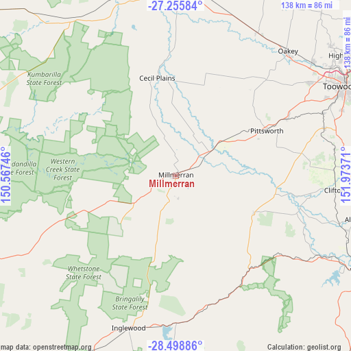
Millmerran GPS coordinates[2]
27° 52' 44.868" South, 151° 16' 14.088" East
| Map corner | latitude | longitude |
|---|---|---|
| Upper-left | -27.25584°, | 150.56746° |
| Center: | -27.87913°, | 151.27058° |
| Lower-right: | -28.49886°, | 151.97371° |
| Map W x H: | 138.2×138.2 km | = 85.9×85.9mi |
| max Lat: | -10.58257° ⇑23.2% North |
| Millmerran: | -27.87913° |
| min Lat: | ⇓76.8% South -43.31423° |
| min Long | Millmerran | max Long |
| 113.53327° | 151.27058° | 153.61246° |
| W 75.1%⇐ | ⇒24.9% E |
Elevation
Elevation of Millmerran is 406 m = 1332 ft, and this is 284 m = 932 ft above average elevation for this country.
| Max E: |
1715 m = 5627 ft | 9.1% |
| Millmerran | 406 m 1332 ft | |
| Avg. | 122 m = 400 ft | |
Min E: |
-2 m = -7 ft | 90.9% |
See also: Australia elevation on elevation.city.
Geographical zone
Millmerran is located in South temperate zone (between Tropic of Capricorn and the Antarctic Circle). Distance of this Southern Tropic circle is 493.9 km =306.9 mi to North.| Distance of | km | miles | from Millmerran |
|---|---|---|---|
| Equator | 3099.9 | 1926.2 | to North |
| Tropic Capricorn | 493.9 | 306.9 | to North |
| Antarctic Circle | 4301.3 | 2672.7 | to South |
| South Pole | 6907.2 | 4291.9 | to South |


Nearby cities:
15 places around Millmerran: (largest is in red/bold)
• Cambooya
60.8 km =37.8 mi,  72°
72°
• Clifton
62.8 km =39 mi,  95°
95°
• Drayton
69.4 km =43.1 mi,  63°
63°
• Glenvale
70.4 km =43.7 mi, 60°
• Greenmount
62.8 km =39 mi,  80°
80°
• Hodgson Vale
69.3 km =43.1 mi, 69°
• Inglewood
62.5 km =38.8 mi,  197°
197°
• Kingsthorpe
69.8 km =43.4 mi,  50°
50°
• Nobby
62 km =38.5 mi,  88°
88°
• Oakey
66.5 km =41.3 mi,  41°
41°
• Pittsworth
40.1 km =24.9 mi, 63°
• Southbrook
49 km =30.4 mi, 63°
• Top Camp
71.1 km =44.2 mi, 67°
• Westbrook
65.5 km =40.7 mi, 63°
• Wyreema
62.7 km =39 mi, 66°
Sources, notices
• [Note1] Compared only with cities in Australia existing in our database
• [Src1] Map data: © OpenStreetMap contributors (CC-BY-SA)
• [Src2] Other city data from geonames.org with taken over terms of usage.
• [Src3] Geographical zone / Annual Mean Temperature by Robert A. Rohde @ Wikipedia
