Loxton geodata
Loxton (South Australia) is a seat of a second-order administrative division; located in Australia in Australia/Adelaide (GMT+10.5) time zone. With population of 4,513 people, there are 1624 cities with bigger population in this country. Compared to other cities in Australia, 62.9% of cities are located further ↑North; 75.8% of cities are located further →East and 50.2% of cities have lower elevation than Loxton. Note1


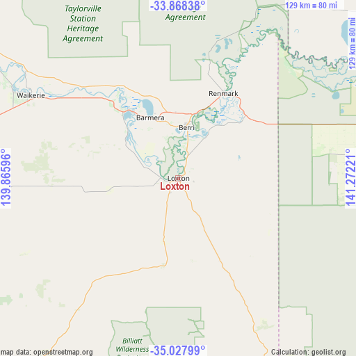
Loxton GPS coordinates[2]
34° 27' 0.72" South, 140° 34' 8.688" East
| Map corner | latitude | longitude |
|---|---|---|
| Upper-left | -33.86838°, | 139.86596° |
| Center: | -34.4502°, | 140.56908° |
| Lower-right: | -35.02799°, | 141.27221° |
| Map W x H: | 128.9×128.9 km | = 80.1×80.1mi |
| max Lat: | -10.58257° ⇑62.9% North |
| Loxton: | -34.4502° |
| min Lat: | ⇓37.1% South -43.31423° |
| min Long | Loxton | max Long |
| 113.53327° | 140.56908° | 153.61246° |
| W 24.2%⇐ | ⇒75.8% E |
Elevation
Elevation of Loxton is 46 m = 151 ft, and this is 76 m = 249 ft below average elevation for this country.
| Max E: |
1715 m = 5627 ft | 49.8% |
| Avg. | 122 m = 400 ft | |
| Loxton | 46 m = 151 ft | |
Min E: |
-2 m = -7 ft | 50.2% |
See also: Australia elevation on elevation.city.
Geographical zone
Loxton is located in South temperate zone (between Tropic of Capricorn and the Antarctic Circle). Distance of this Southern Tropic circle is 1224.6 km =760.9 mi to North.| Distance of | km | miles | from Loxton |
|---|---|---|---|
| Equator | 3830.5 | 2380.2 | to North |
| Tropic Capricorn | 1224.6 | 760.9 | to North |
| Antarctic Circle | 3570.7 | 2218.7 | to South |
| South Pole | 6176.6 | 3838 | to South |


Nearby cities:
15 places around Loxton: (largest is in red/bold)
• Barmera
23.8 km =14.8 mi,  335°
335°
• Berri
19 km =11.8 mi,  8°
8°
• Cadell
87 km =54.1 mi,  301°
301°
• Glossop
19.4 km =12.1 mi,  352°
352°
• Karoonda
94.5 km =58.7 mi,  220°
220°
• Kingston
31.4 km =19.5 mi,  320°
320°
• Loveday
22.3 km =13.9 mi,  326°
326°
• Loxton North
6 km =3.7 mi,  51°
51°
• Monash
23.6 km =14.7 mi,  358°
358°
• Paringa
36.4 km =22.6 mi,  33°
33°
• Pinnaroo
95.5 km =59.3 mi,  160°
160°
• Renmark
34.5 km =21.4 mi, 28°
• Renmark North
38.4 km =23.9 mi,  20°
20°
• Renmark West
34.2 km =21.3 mi, 22°
• Waikerie
61.3 km =38.1 mi, 299°
Sources, notices
• [Note1] Compared only with cities in Australia existing in our database
• [Src1] Map data: © OpenStreetMap contributors (CC-BY-SA)
• [Src2] Other city data from geonames.org with taken over terms of usage.
• [Src3] Geographical zone / Annual Mean Temperature by Robert A. Rohde @ Wikipedia
