Karoonda geodata
Karoonda (South Australia) is a populated place; located in Australia in Australia/Adelaide (GMT+10.5) time zone. With population of 505 people, there are 4867 cities with bigger population in this country. Compared to other cities in Australia, 73% of cities are located further ↑North; 76.1% of cities are located further →East and 59.6% of cities have lower elevation than Karoonda. Note1


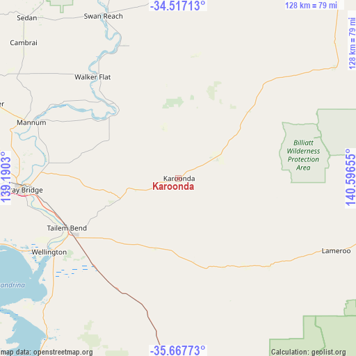
Karoonda GPS coordinates[2]
35° 5' 40.056" South, 139° 53' 36.312" East
| Map corner | latitude | longitude |
|---|---|---|
| Upper-left | -34.51713°, | 139.1903° |
| Center: | -35.09446°, | 139.89342° |
| Lower-right: | -35.66773°, | 140.59655° |
| Map W x H: | 127.9×127.9 km | = 79.5×79.5mi |
| max Lat: | -10.58257° ⇑73% North |
| Karoonda: | -35.09446° |
| min Lat: | ⇓27% South -43.31423° |
| min Long | Karoonda | max Long |
| 113.53327° | 139.89342° | 153.61246° |
| W 23.9%⇐ | ⇒76.1% E |
Elevation
Elevation of Karoonda is 63 m = 207 ft, and this is 59 m = 194 ft below average elevation for this country.
| Max E: |
1715 m = 5627 ft | 40.4% |
| Avg. | 122 m = 400 ft | |
| Karoonda | 63 m = 207 ft | |
Min E: |
-2 m = -7 ft | 59.6% |
See also: Australia elevation on elevation.city.
Geographical zone
Karoonda is located in South temperate zone (between Tropic of Capricorn and the Antarctic Circle). Distance of this Southern Tropic circle is 1296.2 km =805.4 mi to North.| Distance of | km | miles | from Karoonda |
|---|---|---|---|
| Equator | 3902.1 | 2424.7 | to North |
| Tropic Capricorn | 1296.2 | 805.4 | to North |
| Antarctic Circle | 3499 | 2174.2 | to South |
| South Pole | 6104.9 | 3793.4 | to South |


Nearby cities:
15 places around Karoonda: (largest is in red/bold)
• Birdwood
90 km =55.9 mi,  289°
289°
• Callington
77.6 km =48.2 mi,  267°
267°
• Kanmantoo
80.2 km =49.8 mi, 271°
• Lameroo
62.3 km =38.7 mi,  114°
114°
• Mannum
57.3 km =35.6 mi, 290°
• Meningie
82.7 km =51.4 mi,  217°
217°
• Milang
90.7 km =56.4 mi,  247°
247°
• Mount Pleasant
84.8 km =52.7 mi, 294°
• Mount Torrens
88.6 km =55.1 mi, 285°
• Murray Bridge
56.5 km =35.1 mi, 267°
• Nairne
89.6 km =55.7 mi, 274°
• Riverglades
53.8 km =33.4 mi, 269°
• Springton
85 km =52.8 mi,  300°
300°
• Tailem Bend
43.5 km =27 mi, 246°
• Tintinara
89.4 km =55.6 mi,  170°
170°
Sources, notices
• [Note1] Compared only with cities in Australia existing in our database
• [Src1] Map data: © OpenStreetMap contributors (CC-BY-SA)
• [Src2] Other city data from geonames.org with taken over terms of usage.
• [Src3] Geographical zone / Annual Mean Temperature by Robert A. Rohde @ Wikipedia
