Longwarry geodata
Longwarry (Victoria) is a section of populated place; located in Australia in Australia/Melbourne (GMT+11) time zone. With population of 1,989 people, there are 2911 cities with bigger population in this country. Compared to other cities in Australia, 92.9% of cities are located further ↑North; 57.9% of cities are located further →East and 50.4% of cities have higher elevation than Longwarry. Note1


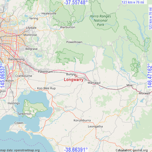
Longwarry GPS coordinates[2]
38° 6' 46.044" South, 145° 46' 6.564" East
| Map corner | latitude | longitude |
|---|---|---|
| Upper-left | -37.55748°, | 145.06537° |
| Center: | -38.11279°, | 145.76849° |
| Lower-right: | -38.66391°, | 146.47162° |
| Map W x H: | 123×123 km | = 76.4×76.4mi |
| max Lat: | -10.58257° ⇑92.9% North |
| Longwarry: | -38.11279° |
| min Lat: | ⇓7.1% South -43.31423° |
| min Long | Longwarry | max Long |
| 113.53327° | 145.76849° | 153.61246° |
| W 42.1%⇐ | ⇒57.9% E |
Elevation
Elevation of Longwarry is 45 m = 148 ft, and this is 77 m = 253 ft below average elevation for this country.
| Max E: |
1715 m = 5627 ft | 50.4% |
| Avg. | 122 m = 400 ft | |
| Longwarry | 45 m = 148 ft | |
Min E: |
-2 m = -7 ft | 49.6% |
See also: Australia elevation on elevation.city.
Geographical zone
Longwarry is located in South temperate zone (between Tropic of Capricorn and the Antarctic Circle). Distance of this Southern Tropic circle is 1631.8 km =1014 mi to North.| Distance of | km | miles | from Longwarry |
|---|---|---|---|
| Equator | 4237.7 | 2633.2 | to North |
| Tropic Capricorn | 1631.8 | 1014 | to North |
| Antarctic Circle | 3163.4 | 1965.6 | to South |
| South Pole | 5769.3 | 3584.9 | to South |


Nearby cities:
15 places around Longwarry: (largest is in red/bold)
• Buln Buln
14.5 km =9 mi,  84°
84°
• Bunyip
4.9 km =3 mi,  289°
289°
• Darnum
22.3 km =13.9 mi,  112°
112°
• Drouin
8.3 km =5.2 mi, 108°
• Garfield
8.6 km =5.3 mi, 287°
• Gembrook
25.8 km =16 mi,  313°
313°
• Lang Lang
24.8 km =15.4 mi,  226°
226°
• Maryknoll
17.4 km =10.8 mi,  299°
299°
• Nar Nar Goon
17.7 km =11 mi,  280°
280°
• Nar Nar Goon North
20.6 km =12.8 mi, 301°
• Neerim South
19.5 km =12.1 mi,  56°
56°
• Nyora
25.9 km =16.1 mi,  198°
198°
• Pakenham Upper
24.5 km =15.2 mi, 295°
• Poowong
25.6 km =15.9 mi,  180°
180°
• Warragul
15.1 km =9.4 mi, 109°
Sources, notices
• [Note1] Compared only with cities in Australia existing in our database
• [Src1] Map data: © OpenStreetMap contributors (CC-BY-SA)
• [Src2] Other city data from geonames.org with taken over terms of usage.
• [Src3] Geographical zone / Annual Mean Temperature by Robert A. Rohde @ Wikipedia
