Laura geodata
Laura (Queensland) is a populated place; located in Australia in Australia/Brisbane (GMT+10) time zone. With population of 520 people, there are 4816 cities with bigger population in this country. Compared to other cities in Australia, 97.9% of cities are located further ↓South; 72% of cities are located further →East and 74.6% of cities have lower elevation than Laura. Note1


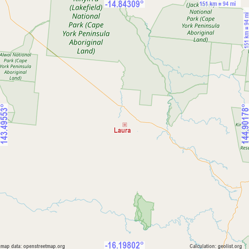
Laura GPS coordinates[2]
15° 31' 18.012" South, 144° 11' 55.14" East
| Map corner | latitude | longitude |
|---|---|---|
| Upper-left | -14.84309°, | 143.49553° |
| Center: | -15.52167°, | 144.19865° |
| Lower-right: | -16.19802°, | 144.90178° |
| Map W x H: | 150.7×150.7 km | = 93.6×93.6mi |
| max Lat: | -10.58257° ⇑2.1% North |
| Laura: | -15.52167° |
| min Lat: | ⇓97.9% South -43.31423° |
| min Long | Laura | max Long |
| 113.53327° | 144.19865° | 153.61246° |
| W 28%⇐ | ⇒72% E |
Elevation
Elevation of Laura is 127 m = 417 ft, and this is 5 m = 16 ft above average elevation for this country.
| Max E: |
1715 m = 5627 ft | 25.4% |
| Laura | 127 m 417 ft | |
| Avg. | 122 m = 400 ft | |
Min E: |
-2 m = -7 ft | 74.6% |
See also: Australia elevation on elevation.city.
Geographical zone
Laura is located in South Torrid zone (between Equator and Tropic of Capricorn). Distance of this Southern Tropic circle is 880.1 km =546.9 mi to South.| Distance of | km | miles | from Laura |
|---|---|---|---|
| Equator | 1725.8 | 1072.4 | to North |
| Tropic Capricorn | 880.1 | 546.9 | to South |
| Antarctic Circle | 5675.3 | 3526.5 | to South |
| South Pole | 8281.2 | 5145.7 | to South |


Nearby cities:
15 places around Laura: (largest is in red/bold)
• Biboohra
199.2 km =123.8 mi,  138°
138°
• Clifton Beach
209.3 km =130.1 mi,  131°
131°
• Cooktown
112.8 km =70.1 mi,  86°
86°
• Cooya Beach
165.1 km =102.6 mi, 128°
• Craiglie
176.7 km =109.8 mi, 129°
• Dimbulah
205.3 km =127.6 mi,  151°
151°
• Hope Vale
101 km =62.8 mi,  75°
75°
• Julatten
171.7 km =106.7 mi, 134°
• Koah
209.5 km =130.2 mi, 136°
• Kuranda
210.9 km =131 mi, 133°
• Mareeba
209.2 km =130 mi, 141°
• Mossman
163.3 km =101.5 mi, 129°
• Mowbray
179.1 km =111.3 mi, 130°
• Palm Cove
207.9 km =129.2 mi, 131°
• Port Douglas
172.7 km =107.3 mi, 128°
Sources, notices
• [Note1] Compared only with cities in Australia existing in our database
• [Src1] Map data: © OpenStreetMap contributors (CC-BY-SA)
• [Src2] Other city data from geonames.org with taken over terms of usage.
• [Src3] Geographical zone / Annual Mean Temperature by Robert A. Rohde @ Wikipedia
