Dirranbandi geodata
Dirranbandi (Queensland) is a populated place; located in Australia in Australia/Brisbane (GMT+10) time zone. With population of 648 people, there are 4448 cities with bigger population in this country. Compared to other cities in Australia, 74.4% of cities are located further ↓South; 51.3% of cities are located further ←West and 79.6% of cities have lower elevation than Dirranbandi. Note1


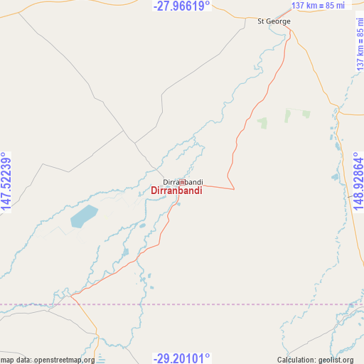
Dirranbandi GPS coordinates[2]
28° 35' 7.476" South, 148° 13' 31.836" East
| Map corner | latitude | longitude |
|---|---|---|
| Upper-left | -27.96619°, | 147.52239° |
| Center: | -28.58541°, | 148.22551° |
| Lower-right: | -29.20101°, | 148.92864° |
| Map W x H: | 137.3×137.3 km | = 85.3×85.3mi |
| max Lat: | -10.58257° ⇑25.6% North |
| Dirranbandi: | -28.58541° |
| min Lat: | ⇓74.4% South -43.31423° |
| min Long | Dirranbandi | max Long |
| 113.53327° | 148.22551° | 153.61246° |
| W 51.3%⇐ | ⇒48.7% E |
Elevation
Elevation of Dirranbandi is 175 m = 574 ft, and this is 53 m = 174 ft above average elevation for this country.
| Max E: |
1715 m = 5627 ft | 20.4% |
| Dirranbandi | 175 m 574 ft | |
| Avg. | 122 m = 400 ft | |
Min E: |
-2 m = -7 ft | 79.6% |
See also: Australia elevation on elevation.city.
Geographical zone
Dirranbandi is located in South temperate zone (between Tropic of Capricorn and the Antarctic Circle). Distance of this Southern Tropic circle is 572.5 km =355.7 mi to North.| Distance of | km | miles | from Dirranbandi |
|---|---|---|---|
| Equator | 3178.4 | 1975 | to North |
| Tropic Capricorn | 572.5 | 355.7 | to North |
| Antarctic Circle | 4222.8 | 2623.9 | to South |
| South Pole | 6828.7 | 4243.2 | to South |


Nearby cities:
15 places around Dirranbandi: (largest is in red/bold)
• Boggabilla
208.3 km =129.4 mi,  90°
90°
• Brewarrina
202.3 km =125.7 mi,  220°
220°
• Collarenebri
111.9 km =69.5 mi,  162°
162°
• Cunnamulla
255.3 km =158.6 mi,  283°
283°
• Goondiwindi
203.2 km =126.3 mi, 88°
• Lightning Ridge
96.7 km =60.1 mi,  194°
194°
• Mitchell
234.9 km =146 mi,  353°
353°
• Moree
184.9 km =114.9 mi,  121°
121°
• Mungindi
86.1 km =53.5 mi, 120°
• Narrabri
245.2 km =152.4 mi,  142°
142°
• Roma
231.1 km =143.6 mi,  13°
13°
• St George
80.3 km =49.9 mi,  27°
27°
• Walgett
160.4 km =99.7 mi,  183°
183°
• Warialda
252 km =156.6 mi, 115°
• Wee Waa
217.1 km =134.9 mi,  147°
147°
Sources, notices
• [Note1] Compared only with cities in Australia existing in our database
• [Src1] Map data: © OpenStreetMap contributors (CC-BY-SA)
• [Src2] Other city data from geonames.org with taken over terms of usage.
• [Src3] Geographical zone / Annual Mean Temperature by Robert A. Rohde @ Wikipedia
